
| Prel. Rep. | Date | Time(UTC) | Time(Local) | Lat. | Lon. | Depth | Mag. | Region | Waveform |
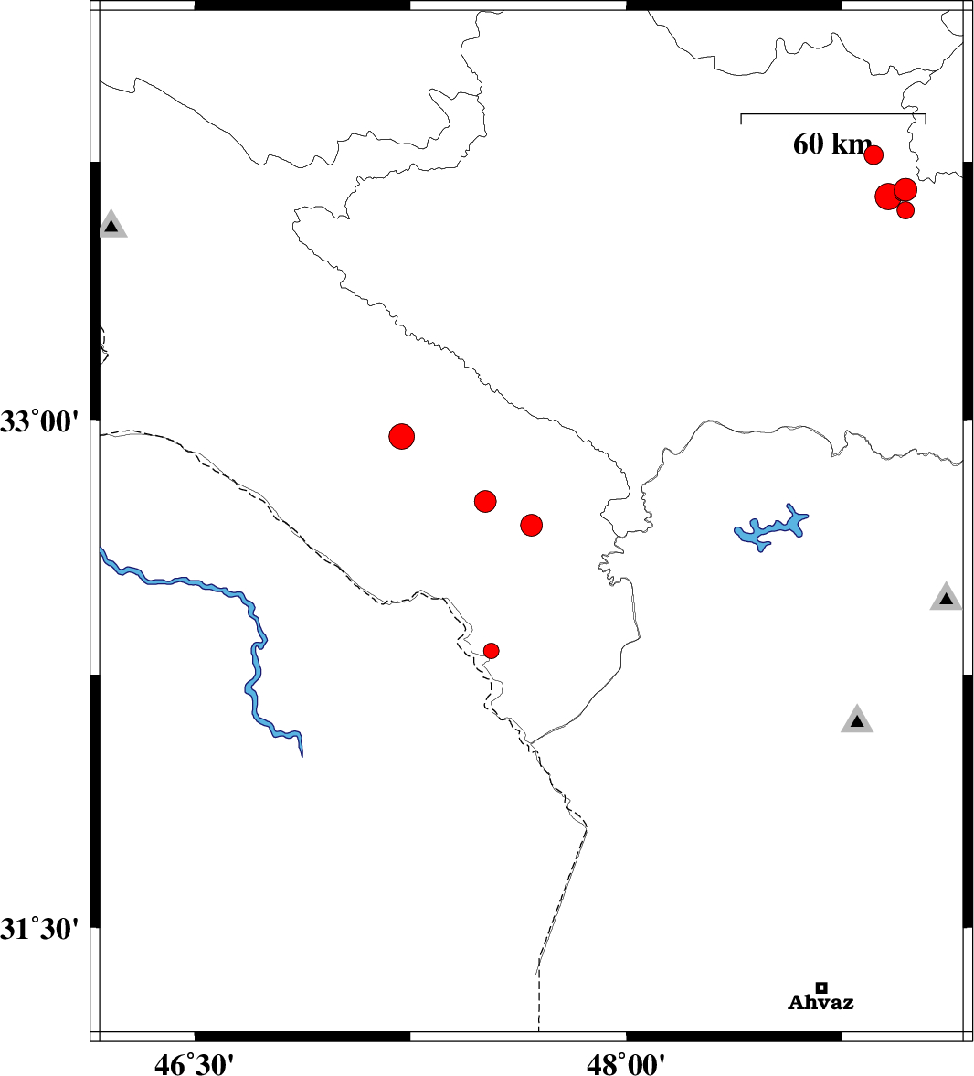
| 2015/01/11 | 05:03:49.6 | 08:33:49.6 | 32.69 | 47.67 | 14 | ML:3.4 | Ilam Province, 39 km East of Dehloran | ||
| 2015/01/07 | 09:57:26.3 | 13:27:26.3 | 33.77 | 48.86 | 14 | ML:3 | Lorestan Province, 17 km South-East of Borujerd | ||
| 2015/01/07 | 00:32:07.7 | 04:02:07.7 | 32.76 | 47.51 | 18 | ML:3.4 | Ilam Province, 20 km South of Abdanan | ||
| 2015/01/06 | 21:20:44.9 | 00:50:44.9 | 33.67 | 48.97 | 16 | ML:3.5 | Lorestan Province, 23 km North-West of Dorud | ||
| 2015/01/06 | 19:00:29.4 | 22:30:29.4 | 33.61 | 48.97 | 15 | ML:2.7 | Lorestan Province, 17 km North of Dorud | ||
| 2015/01/06 | 16:40:16.0 | 20:10:16.0 | 33.66 | 48.96 | 14 | ML:2.6 | Lorestan Province, 23 km North-West of Dorud | ||
| 2015/01/06 | 16:34:44.4 | 20:04:44.4 | 33.65 | 48.91 | 15 | ML:4.1 | Lorestan Province, 24 km North-West of Dorud | ||
| 2015/01/05 | 02:37:49.2 | 06:07:49.2 | 32.95 | 47.22 | 17 | ML:3.9 | Ilam Province, 21 km South of Darreh Shahr | ||
| 2015/01/04 | 16:25:38.8 | 19:55:38.8 | 32.32 | 47.53 | 15 | ML:2.4 | Ilam Province, 49 km South-East of Dehloran |