
Magnitude |
:2.7 |
| Date & Time (UTC) | 2015-01-06 19:00:29.4 |
| Date & Time (Local) | 1393/10/16 22:30:29.4 |
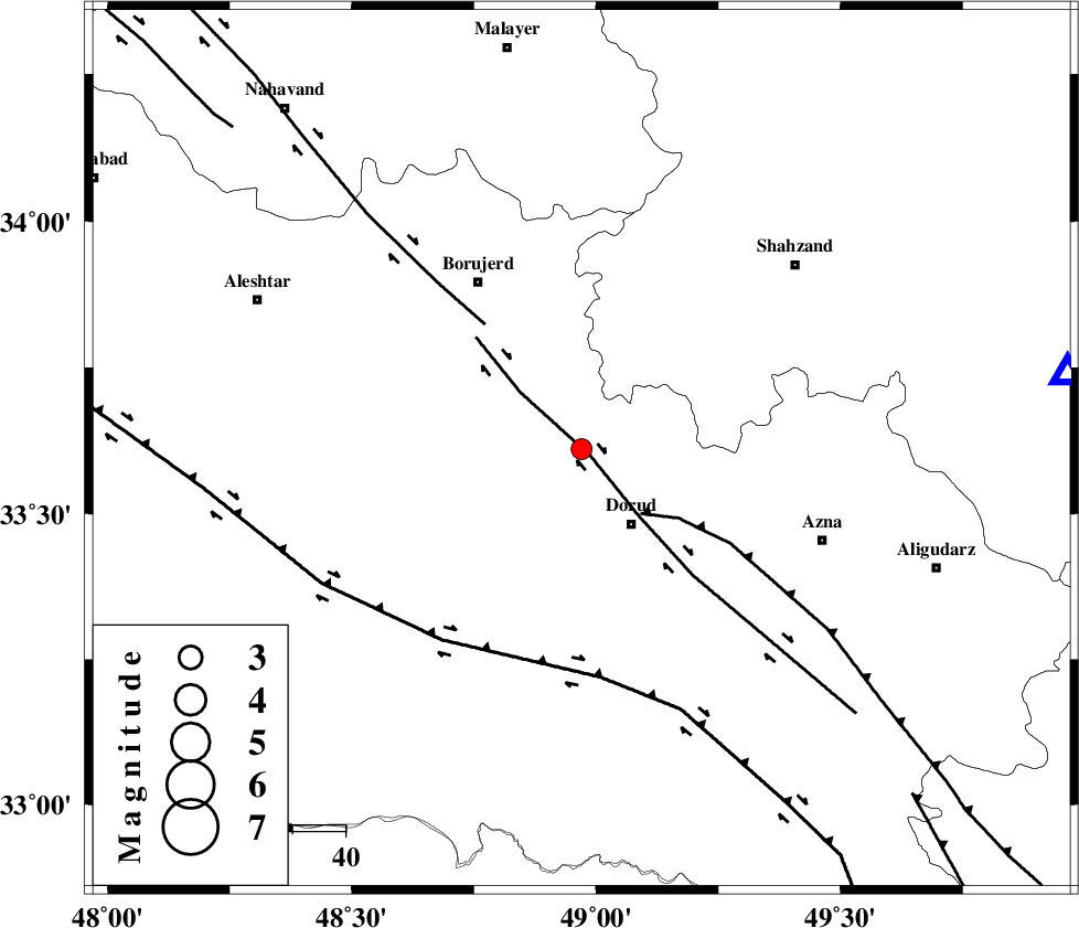
| Location | Lat:33.61 Lon: 48.97 |
| Region | Lorestan Province, 17 km North of Dorud |
Nearest Cities |
|
| 2 km of Kagheh, Lorestan Province | |
| 10 km North of Void, Lorestan Province | |
| 10 km of Chalanchulan, Lorestan Province | |
| 10 km North of Razan, Lorestan Province | |
| 16 km North West of Zhan, Lorestan Province | |
| Depth | 15 km |
| Agency | |
Faults within 150 km: |
|
| DORUD (Length: 100 km) , Distance to epicenter: 2 km | |
| MAIN_ZAGROS_R_F (Length: 1106 km) , Distance to epicenter: 17 km | |
| NAHAVAND_F (Length: 102 km) , Distance to epicenter: 30 km | |
| Number of Phases | 3 |
| RMS | 0 |
| Number of Stations | 5 |
| Error in Latitude | >4.9 km |
| Error in Longitude | 2.2 km |
| Error in Depth | 0 km |
Download waveform in seisan format
to download seisan software Click here
to access information about IIEES stations Click here
Amplitude | ||||||||
| UID | Agency | Station | Component | Amplitude | Period | Arrival Time | Proccessing Time | Signal Clip |
| 94719 | IIEES | SHGR | N | 74.1 | 0.32 | 2015-01-06 19:01:26 | 2015-01-06 07:46:00 | n |
| 94720 | IIEES | GHVR | N | 60.5 | 0.92 | 2015-01-06 19:01:40 | 2015-01-06 07:46:00 | n |
Phase | ||||||||||||
| Agency | Station | Component | Phase Type | Phase Quality | First Motion | Observed Arrival Time | Time Residual | Loc. Flag | Input Weight | Distance | Azimuth | |
| IIEES | KHMZ | Z | Pg | E | 2015-01-06 19:00:45 | -0.01 | y | 93 | 81 | |||
| IIEES | ASAO | Z | Pg | E | 2015-01-06 19:00:53 | 0.01 | y | 142 | 43 | |||
| IIEES | SNGE | Z | Pn | E | 2015-01-06 19:01:04 | 0 | y | 222 | 318 | |||