| Prel. Rep. | Date | Time(UTC) | Time(Local) | Lat. | Lon. | Depth | Mag. | Region | Waveform |
|
|
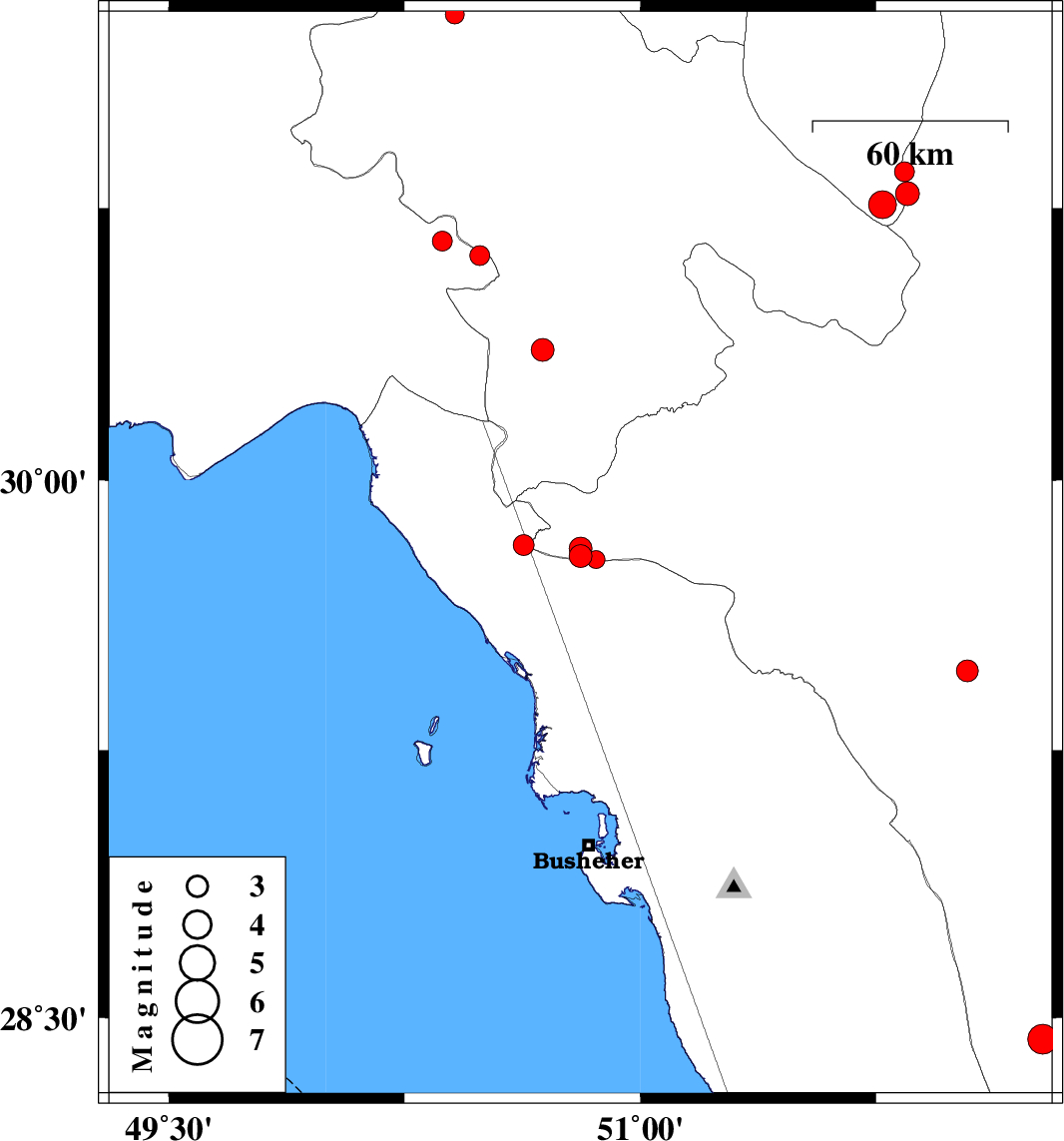
2012/06/05
|
21:38:09.8
|
02:08:09.8
| 29.79 | 50.81 | 31 |
ML:3.2
|
Fars Province, 38 km North-East of Bandar-e genaveh | |
|
|
2012/06/04
|
19:04:19.9
|
23:34:19.9
| 29.82 | 50.63 | 46 |
ML:2.9
|
Bushehr Province, 29 km North-East of Bandar-e genaveh | |
|
|
2012/06/04
|
13:46:45.1
|
18:16:45.1
| 29.78 | 50.86 | 44 |
ML:2.6
|
Fars Province, 41 km North-East of Bandar-e genaveh | |
|
|
2012/06/04
|
13:40:31.7
|
18:10:31.7
| 29.81 | 50.81 | 40 |
ML:3.2
|
Fars Province, 38 km North-East of Bandar-e genaveh | |
|
|
2012/06/01
|
09:34:34.8
|
14:04:34.8
| 30.36 | 50.69 | 43 |
ML:3.2
|
Kohkiluieh va boyerahmad Province, 9 km Dogonbadan | |
|
|
2012/05/30
|
06:55:44.7
|
11:25:44.7
| 28.44 | 52.28 | 37 |
ML:4.3
|
Fars Province, 51 km South-East of Farashband | |
|
|
2012/05/15
|
04:11:44.8
|
08:41:44.8
| 31.28 | 50.41 | 14 |
ML:2.7
|
Kohkiluieh va boyerahmad Province, 45 km South-West of Lordegan | |
|
|
2012/05/14
|
18:05:25.7
|
22:35:25.7
| 30.79 | 51.85 | 14 |
ML:3.4
|
Esfahan Province, 30 km North-East of Yasuj | |
|
|
2012/05/14
|
17:18:46.9
|
21:48:46.9
| 30.85 | 51.84 | 14 |
ML:2.8
|
Fars Province, 37 km East of Sisakht | |
|
|
2012/05/14
|
17:12:48.6
|
21:42:48.6
| 30.76 | 51.77 | 15 |
ML:3.9
|
Esfahan Province, 21 km East of Yasuj | |
|
|
2012/05/08
|
08:52:42.0
|
13:22:42.0
| 30.66 | 50.37 | 15 |
ML:2.8
|
Khoozestan Province, 14 km East of Behbahan | |
|
|
2012/05/07
|
21:48:01.0
|
02:18:01.0
| 30.62 | 50.49 | 14 |
ML:2.8
|
Khoozestan Province, 20 km South of Dehdasht | |
|
|
2012/05/07
|
02:10:25.7
|
06:40:25.7
| 29.47 | 52.04 | 14 |
ML:3.1
|
Fars Province, 41 km South-East of Kazerun | |
