| Prel. Rep. | Date | Time(UTC) | Time(Local) | Lat. | Lon. | Depth | Mag. | Region | Waveform |
|
|
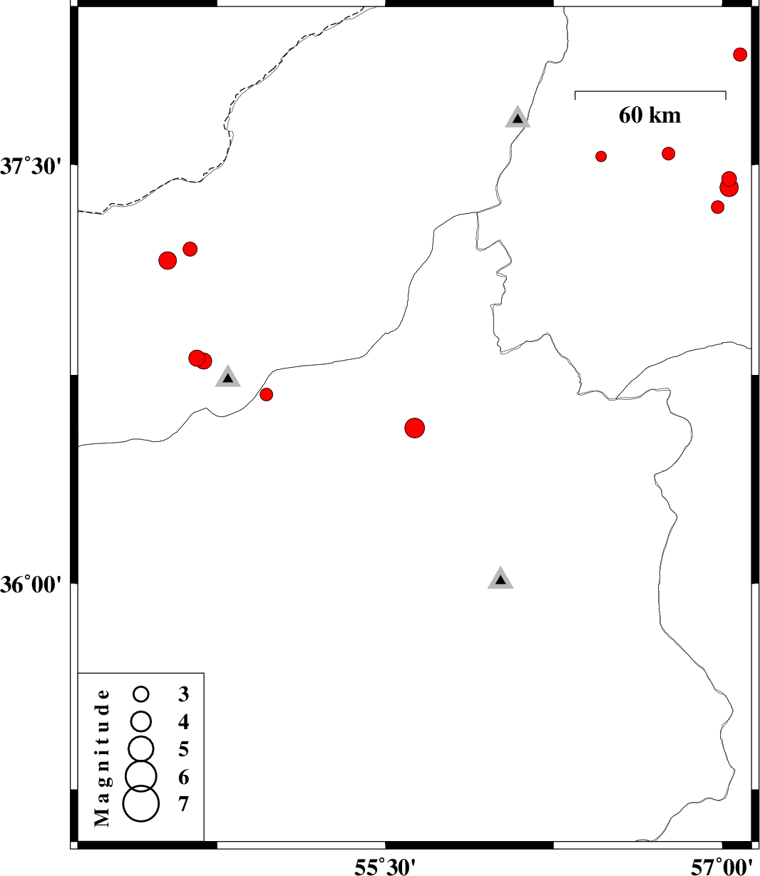
2012/05/02
|
16:44:31.2
|
21:14:31.2
| 36.56 | 55.63 | 14 |
ML:3.9
|
Semnan Province, 61 km North-East of Shahrud | |
|
|
2012/04/29
|
12:16:11.5
|
16:46:11.5
| 36.81 | 54.66 | 14 |
ML:3.2
|
Golestan Province, 20 km East of Gorgan | |
|
|
2012/04/29
|
00:58:25.8
|
05:28:25.8
| 36.8 | 54.69 | 16 |
ML:3.3
|
Golestan Province, 20 km South-West of Ali Abad | |
|
|
2012/04/19
|
18:01:00.3
|
22:31:00.3
| 37.45 | 57.03 | 17 |
ML:2.9
|
Khorasan(north) Province, 14 km Ashkhaneh | |
|
|
2012/04/19
|
04:50:25.8
|
09:20:25.8
| 37.54 | 56.76 | 18 |
ML:2.5
|
Khorasan(north) Province, 16 km West of Ashkhaneh | |
|
|
2012/04/17
|
12:58:41.9
|
17:28:41.9
| 37.53 | 56.46 | 46 |
ML:2.1
|
Khorasan(north) Province, 42 km West of Ashkhaneh | |
|
|
2012/04/16
|
04:22:21.5
|
08:52:21.5
| 37.42 | 57.03 | 15 |
ML:3.6
|
Khorasan(north) Province, 16 km South of Ashkhaneh | |
|
|
2012/04/15
|
20:37:56.9
|
01:07:56.9
| 37.89 | 57.08 | 16 |
ML:2.7
|
Khorasan(north) Province, 39 km North-East of Ashkhaneh | |
|
|
2012/04/15
|
09:02:20.3
|
13:32:20.3
| 37.35 | 56.98 | 46 |
ML:2.5
|
Khorasan(north) Province, 22 km South of Ashkhaneh | |
|
|
2012/04/12
|
15:01:41.3
|
19:31:41.3
| 37.16 | 54.53 | 14 |
ML:3.5
|
Golestan Province, 18 km North of Aq Qaleh | |
|
|
2012/04/09
|
09:23:46.3
|
13:53:46.3
| 37.2 | 54.63 | 28 |
ML:2.8
|
Golestan Province, 26 km North-East of Aq Qaleh | |
|
|
2012/04/09
|
05:07:12.5
|
09:37:12.5
| 36.68 | 54.97 | 14 |
ML:2.6
|
Semnan Province, 29 km North of Shahrud | |
