
Magnitude |
:3.2 |
| Date & Time (UTC) | 2012-04-29 12:16:11.5 |
| Date & Time (Local) | 1391/2/10 16:46:11.5 |
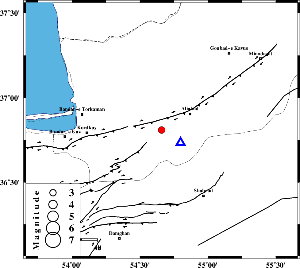
| Location | Lat:36.81 Lon: 54.66 |
| Region | Golestan Province, 20 km East of Gorgan |
Nearest Cities |
|
| 11 km East of Jalin olia, Golestan Province | |
| 19 km South of Nodeh malek, Golestan Province | |
| 20 km East of Gorgan, Golestan Province | |
| 21 km West of Ali Abad, Golestan Province | |
| 25 km North East of Naharkhoran, Golestan Province | |
| Depth | 14 km |
| Agency | |
Faults within 150 km: |
|
| KHAZAR_F (Length: 523 km) , Distance to epicenter: 15 km | |
| SHAVAR_F (Length: 87 km) , Distance to epicenter: 29 km | |
| N_ALBORZ_F (Length: 360 km) , Distance to epicenter: 32 km | |
| Number of Phases | 7 |
| RMS | 0 |
| Number of Stations | 6 |
| Error in Latitude | >1.8 km |
| Error in Longitude | 2.7 km |
| Error in Depth | 5.6 km |
Download waveform in seisan format
to download seisan software Click here
to access information about IIEES stations Click here
Amplitude | ||||||||
| UID | Agency | Station | Component | Amplitude | Period | Arrival Time | Proccessing Time | Signal Clip |
| 83160 | IIEES | MRVT | E | 450.6 | 0.16 | 2012-04-29 12:17:00 | 2012-04-29 12:43:00 | n |
| 83161 | IIEES | MRVT | N | 330.3 | 0.24 | 2012-04-29 12:17:01 | 2012-04-29 12:43:00 | n |
| 83162 | IIEES | CHTH | E | 53.6 | 0.92 | 2012-04-29 12:17:50 | 2012-04-29 12:43:00 | n |
| 83163 | IIEES | THKV | E | 65.5 | 0.52 | 2012-04-29 12:17:51 | 2012-04-29 12:43:00 | n |
Phase | ||||||||||||
| Agency | Station | Component | Phase Type | Phase Quality | First Motion | Observed Arrival Time | Time Residual | Loc. Flag | Input Weight | Distance | Azimuth | |
| IIEES | SHRO | Z | Pg | E | 2012-04-29 12:16:36 | -0.05 | y | 150 | 126 | |||
| IIEES | SHRO | E | Sg | E | 2012-04-29 12:16:54 | 0.03 | y | 150 | 126 | |||
| IIEES | MRVT | Z | Pg | E | 2012-04-29 12:16:37 | 0.02 | y | 158 | 53 | |||
| IIEES | DAMV | Z | Pn | E | 2012-04-29 12:16:53 | 0.06 | y | 275 | 242 | |||
| IIEES | CHTH | Z | Pn | E | 2012-04-29 12:17:00 | -0.07 | y | 333 | 254 | |||
| IIEES | THKV | Z | Pn | E | 2012-04-29 12:17:03 | 0.01 | y | 354 | 255 | |||
| IIEES | TABS | Z | Pn | E | 2012-04-29 12:17:10 | -0.01 | y | 416 | 147 | |||