
Magnitude |
:2.5 |
| Date & Time (UTC) | 2012-04-15 09:02:20.3 |
| Date & Time (Local) | 1391/1/27 13:32:20.3 |
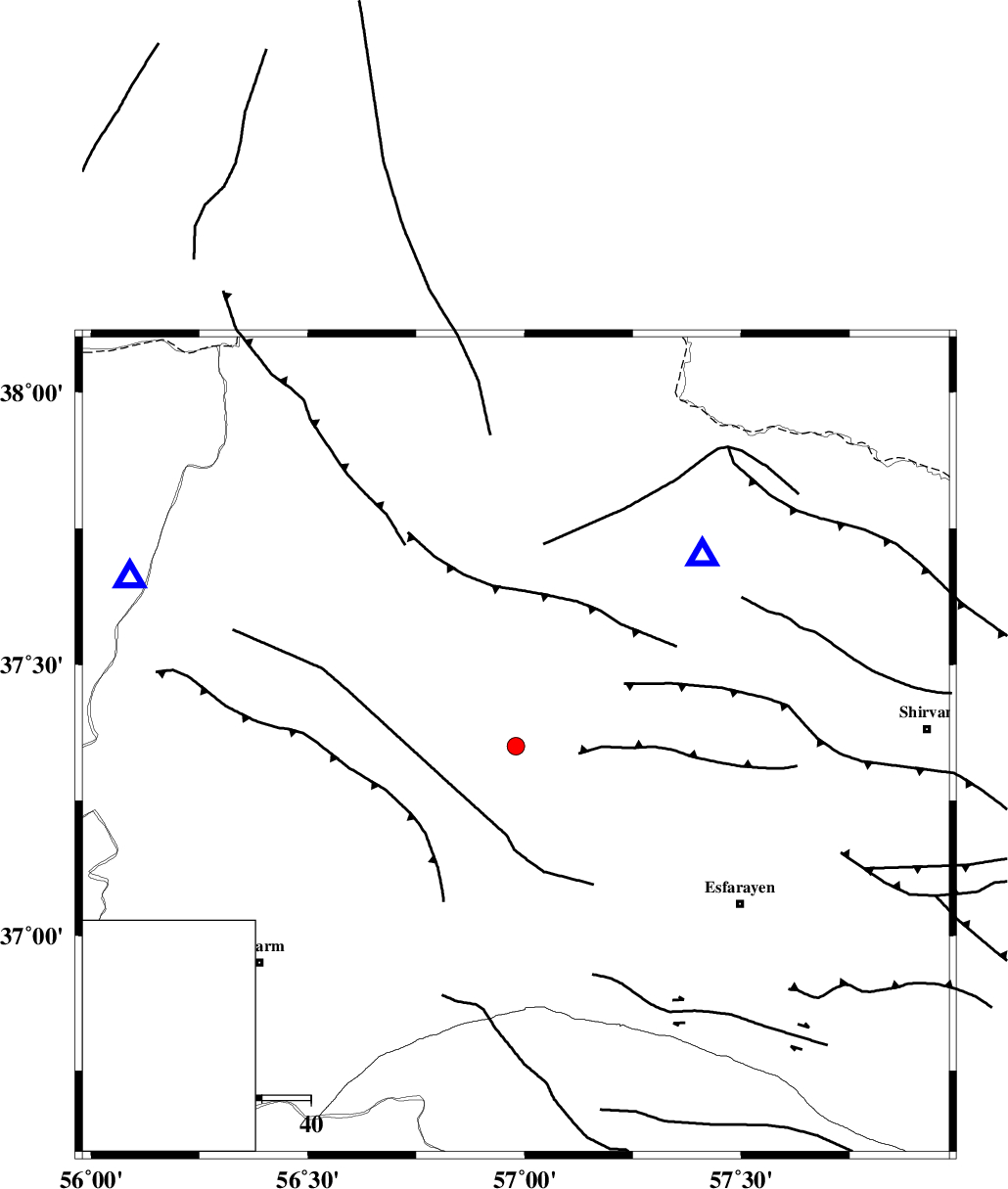
| Location | Lat:37.35 Lon: 56.98 |
| Region | Khorasan(north) Province, 22 km South of Ashkhaneh |
Nearest Cities |
|
| 12 km North East of Shogan, Khorasan(north) Province | |
| 23 km South of Ashkhaneh, Khorasan(north) Province | |
| 32 km North West of Cheharborj, Khorasan(north) Province | |
| 34 km South of Pish qaleh, Khorasan(north) Province | |
| 34 km South West of Void, Khorasan(north) Province | |
| Depth | 46 km |
| Agency | |
Faults within 150 km: |
|
| ROBATE_QARABIL_F (Length: 168 km) , Distance to epicenter: 2 km | |
| ESFARAYEN_F (Length: 111 km) , Distance to epicenter: 14 km | |
| JAJARAM_F (Length: 77 km) , Distance to epicenter: 36 km | |
| Number of Phases | 5 |
| RMS | 0 |
| Number of Stations | 3 |
| Error in Latitude | >1.9 km |
| Error in Longitude | 1.9 km |
| Error in Depth | 8.3 km |
Download waveform in seisan format
to download seisan software Click here
to access information about IIEES stations Click here
Amplitude | ||||||||
| UID | Agency | Station | Component | Amplitude | Period | Arrival Time | Proccessing Time | Signal Clip |
| 82755 | IIEES | MRVT | E | 163.2 | 0.33 | 2012-04-15 09:02:48 | 2012-04-15 09:20:00 | n |
Phase | ||||||||||||
| Agency | Station | Component | Phase Type | Phase Quality | First Motion | Observed Arrival Time | Time Residual | Loc. Flag | Input Weight | Distance | Azimuth | |
| IIEES | BJRD | Z | Pg | E | 2012-04-15 09:02:31 | 0.02 | y | 54.2 | 44 | |||
| IIEES | MRVT | Z | Pg | E | 2012-04-15 09:02:35 | -0.01 | y | 85.8 | 294 | |||
| IIEES | MRVT | N | Sg | E | 2012-04-15 09:02:47 | -0.01 | y | 85.8 | 294 | |||
| IIEES | SHRO | Z | Pg | E | 2012-04-15 09:02:48 | -0.06 | y | 172 | 210 | |||
| IIEES | SHRO | N | Sg | E | 2012-04-15 09:03:09 | 0.07 | y | 172 | 210 | |||