
Magnitude |
:2.6 |
| Date & Time (UTC) | 2012-04-09 05:07:12.5 |
| Date & Time (Local) | 1391/1/21 09:37:12.5 |
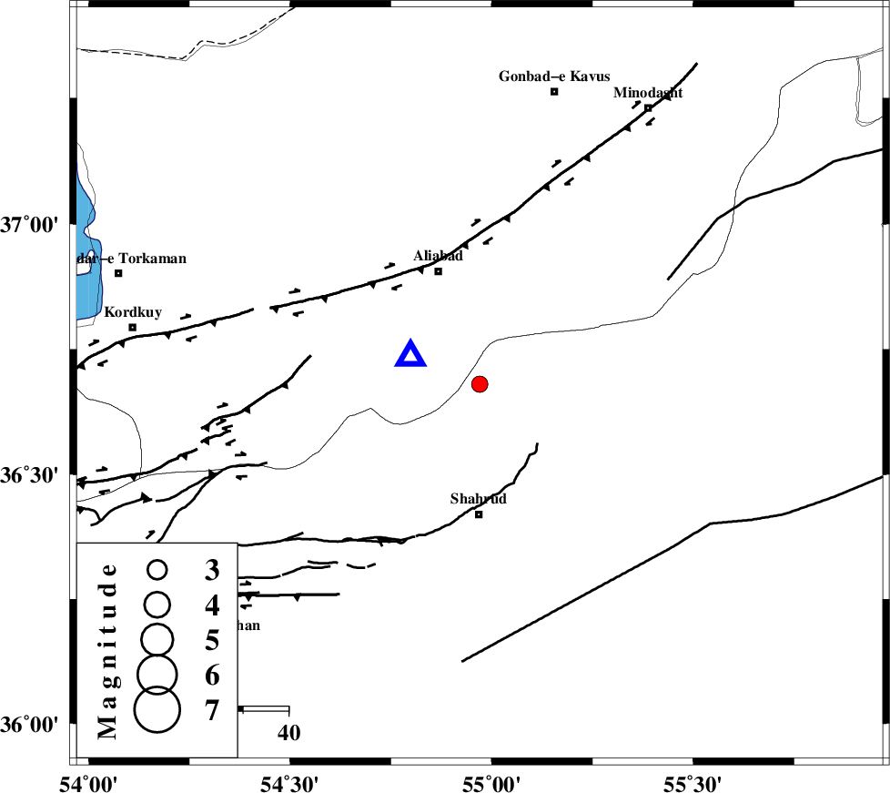
| Location | Lat:36.68 Lon: 54.97 |
| Region | Semnan Province, 29 km North of Shahrud |
Nearest Cities |
|
| 13 km North West of Qaleh-ye nokharqan, Semnan Province | |
| 22 km North of Bastam, Semnan Province | |
| 27 km South East of Ali Abad, Golestan Province | |
| 29 km North of Shahrud, Semnan Province | |
| 31 km North West of Kalateh khanj, Semnan Province | |
| Depth | 14 km |
| Agency | |
Faults within 150 km: |
|
| SHAVAR_F (Length: 87 km) , Distance to epicenter: 10 km | |
| KHAZAR_F (Length: 523 km) , Distance to epicenter: 36 km | |
| ASTANEH_F (Length: 72 km) , Distance to epicenter: 39 km | |
| Number of Phases | 6 |
| RMS | 0.2 |
| Number of Stations | 5 |
| Error in Latitude | >3 km |
| Error in Longitude | 4.1 km |
| Error in Depth | 6.6 km |
Download waveform in seisan format
to download seisan software Click here
to access information about IIEES stations Click here
Amplitude | ||||||||
| UID | Agency | Station | Component | Amplitude | Period | Arrival Time | Proccessing Time | Signal Clip |
| 82691 | IIEES | MRVT | E | 144.8 | 0.16 | 2012-04-09 05:07:59 | 2012-04-09 05:20:00 | n |
| 82692 | IIEES | DAMV | E | 20.8 | 0.35 | 2012-04-09 05:08:46 | 2012-04-09 05:20:00 | n |
Phase | ||||||||||||
| Agency | Station | Component | Phase Type | Phase Quality | First Motion | Observed Arrival Time | Time Residual | Loc. Flag | Input Weight | Distance | Azimuth | |
| IIEES | SHRO | Z | Pg | E | 2012-04-09 05:07:32 | -0.13 | y | 119 | 128 | |||
| IIEES | MRVT | Z | Pg | E | 2012-04-09 05:07:36 | -0.37 | y | 147 | 42 | |||
| IIEES | BJRD | Z | Pn | E | 2012-04-09 05:07:50 | 0.28 | y | 244 | 62 | |||
| IIEES | BJRD | N | Sg | E | 2012-04-09 05:08:21 | 0.14 | y | 244 | 62 | |||
| IIEES | DAMV | Z | Pn | E | 2012-04-09 05:07:57 | 0.08 | y | 294 | 248 | |||
| IIEES | TABS | Z | Pn | E | 2012-04-09 05:08:08 | 0 | y | 389 | 149 | |||