
| Prel. Rep. | Date | Time(UTC) | Time(Local) | Lat. | Lon. | Depth | Mag. | Region | Waveform |
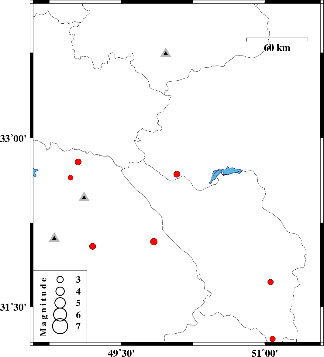
| 2004/12/07 | 14:59:07.0 | 18:29:07.0 | 32.68 | 50.08 | 14 | ML:3 | 23 km North of Chelgard, Chaharmahal Bakhtiari Province | ||
| 2004/12/05 | 00:46:55.4 | 04:16:55.4 | 31.21 | 51.08 | 14 | ML:2.7 | 41 km South-East of Lordegan, Chaharmahal Bakhtiari Province | ||
| 2004/12/05 | 00:41:29.8 | 04:11:29.8 | 31.72 | 51.06 | 27 | ML:2.7 | 34 km North-East of Lordegan, Chaharmahal Bakhtiari Province | ||
| 2004/12/04 | 17:41:44.6 | 21:11:44.6 | 32.65 | 48.97 | 28 | ML:2.4 | 31 km North-West of Lali, Khoozestan Province | ||
| 2004/12/02 | 01:54:57.8 | 05:24:57.8 | 32.08 | 49.84 | 14 | ML:3.2 | 27 km North of Izeh, Khoozestan Province | ||
| 2004/12/01 | 20:49:27.1 | 00:19:27.1 | 32.04 | 49.2 | 17 | ML:2.9 | 15 km North-West of Masjed Soleyman, Khoozestan Province | ||
| 2004/12/01 | 07:13:45.5 | 10:43:45.5 | 31.69 | 49.1 | 18 | ML:2.9 | 32 km South-West of Masjed Soleyman, Khoozestan Province | ||
| 2004/12/01 | 03:59:33.8 | 07:29:33.8 | 32.79 | 49.05 | 10 | ML:2.9 | 44 km North of Lali, Khoozestan Province |