
Magnitude |
:2.7 |
| Date & Time (UTC) | 2004-12-05 00:41:29.8 |
| Date & Time (Local) | 1383/9/15 04:11:29.8 |
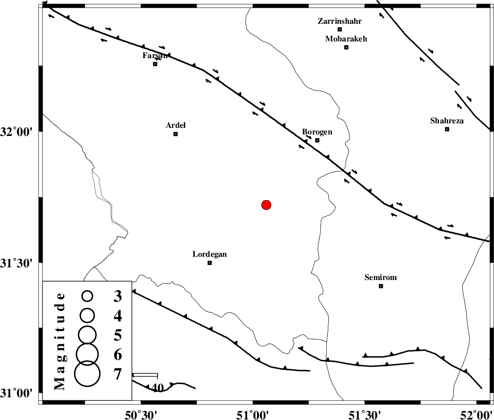
| Location | Lat:31.72 Lon: 51.06 |
| Region | 34 km North-East of Lordegan, Chaharmahal Bakhtiari Province |
Nearest Cities |
|
| 19 km South of Gandoman, Chaharmahal Bakhtiari Province | |
| 19 km North of Aluni, Chaharmahal Bakhtiari Province | |
| 23 km South of Baladaji, Chaharmahal Bakhtiari Province | |
| 27 km North East of Armand-e olia, Chaharmahal Bakhtiari Province | |
| 33 km South West of Faradonbeh, Chaharmahal Bakhtiari Province | |
| Depth | 27 km |
| Agency | |
Faults within 150 km: |
|
| DOPOLAN_F (Length: 107 km) , Distance to epicenter: 5 km | |
| DENA_F (Length: 137 km) , Distance to epicenter: 12 km | |
| SABZKUH_F (Length: 67 km) , Distance to epicenter: 15 km | |
| Number of Phases | 5 |
| RMS | 0.1 |
| Number of Stations | 5 |
| Error in Latitude | >4.6 km |
| Error in Longitude | 2.5 km |
| Error in Depth | 4.8 km |
Download waveform in seisan format
to download seisan software Click here
to access information about IIEES stations Click here
Amplitude | ||||||||
| UID | Agency | Station | Component | Amplitude | Period | Arrival Time | Proccessing Time | Signal Clip |
| 31313 | IIEES | SHGO | N | 57.6 | 0.65 | 2004-12-05 00:42:45 | 2006-03-15 11:56:00 | n |
| 31314 | IIEES | SHGO | E | 75.7 | 0.55 | 2004-12-05 00:42:52 | 2006-03-15 11:56:00 | n |
Phase | ||||||||||||
| Agency | Station | Component | Phase Type | Phase Quality | First Motion | Observed Arrival Time | Time Residual | Loc. Flag | Input Weight | Distance | Azimuth | |
| IIEES | NASN | Z | PG | E | 2004-12-05 00:42:02 | 0 | y | 204 | 53 | |||
| IIEES | SHGO | Z | PG | E | 2004-12-05 00:42:04 | 0 | y | 218 | 282 | |||
| IIEES | ASAO | Z | PN | E | 2004-12-05 00:42:17 | -0.2 | y | 329 | 343 | |||
| IIEES | SNGE | Z | PN | E | 2004-12-05 00:42:40 | 0.3 | y | 509 | 318 | |||
| IIEES | KRBR | Z | PN | E | 2004-12-05 00:42:48 | 0 | y | 578 | 108 | |||