
Magnitude |
:2.7 |
| Date & Time (UTC) | 2004-12-05 00:46:55.4 |
| Date & Time (Local) | 1383/9/15 04:16:55.4 |
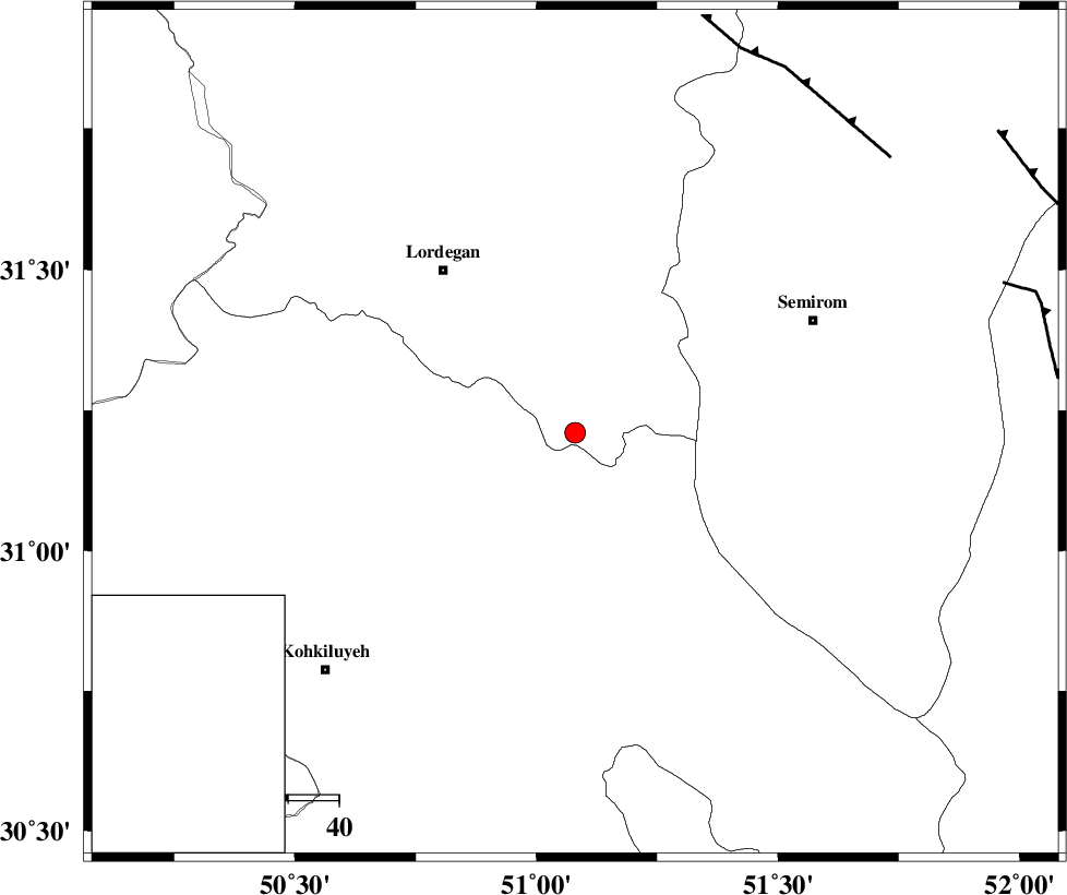
| Location | Lat:31.21 Lon: 51.08 |
| Region | 41 km South-East of Lordegan, Chaharmahal Bakhtiari Province |
Nearest Cities |
|
| 16 km North of Dezhak, Kohkiluieh va boyerahmad Province | |
| 19 km North West of Meymand, Kohkiluieh va boyerahmad Province | |
| 22 km West of Malkhalifeh, Chaharmahal Bakhtiari Province | |
| 24 km North of Margun, Kohkiluieh va boyerahmad Province | |
| 28 km South East of Sardasht, Chaharmahal Bakhtiari Province | |
| Depth | 14 km |
| Agency | |
Faults within 150 km: |
|
| DENA_F (Length: 137 km) , Distance to epicenter: 22 km | |
| DOPOLAN_F (Length: 107 km) , Distance to epicenter: 52 km | |
| SABZKUH_F (Length: 67 km) , Distance to epicenter: 61 km | |
| Number of Phases | 4 |
| RMS | 0.3 |
| Number of Stations | 3 |
| Error in Latitude | >7.2 km |
| Error in Longitude | 6.3 km |
| Error in Depth | 12.6 km |
Download waveform in seisan format
to download seisan software Click here
to access information about IIEES stations Click here
Amplitude | ||||||||
| UID | Agency | Station | Component | Amplitude | Period | Arrival Time | Proccessing Time | Signal Clip |
| 31315 | IIEES | SHGO | N | 77.4 | 0.75 | 2004-12-05 00:48:09 | 2006-03-15 11:56:00 | n |
| 31316 | IIEES | SHGO | E | 94.7 | 0.65 | 2004-12-05 00:48:15 | 2006-03-15 11:56:00 | n |
| 31317 | IIEES | ASAO | E | 9.5 | 0.92 | 2004-12-05 00:48:47 | 2006-03-15 11:56:00 | n |
| 31318 | IIEES | ASAO | N | 8.9 | 0.6 | 2004-12-05 00:48:58 | 2006-03-15 11:56:00 | n |
Phase | ||||||||||||
| Agency | Station | Component | Phase Type | Phase Quality | First Motion | Observed Arrival Time | Time Residual | Loc. Flag | Input Weight | Distance | Azimuth | |
| IIEES | SHGO | Z | PG | E | 2004-12-05 00:47:34 | -0.2 | y | 238 | 295 | |||
| IIEES | NASN | Z | PG | E | 2004-12-05 00:47:34 | -0.2 | y | 240 | 42 | |||
| IIEES | ASAO | Z | PN | E | 2004-12-05 00:47:51 | 0.5 | y | 383 | 345 | |||
| IIEES | ASAO | E | SG | E | 2004-12-05 00:48:42 | -0.1 | y | 383 | 345 | |||