
Magnitude |
:2.4 |
| Date & Time (UTC) | 2004-12-04 17:41:44.6 |
| Date & Time (Local) | 1383/9/14 21:11:44.6 |
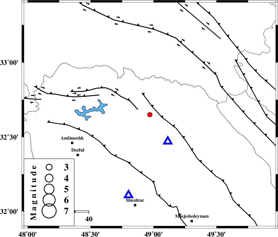
| Location | Lat:32.65 Lon: 48.97 |
| Region | 31 km North-West of Lali, Khoozestan Province |
Nearest Cities |
|
| 21 km North East of Sardasht, Khoozestan Province | |
| 22 km South East of Shuy, Khoozestan Province | |
| 32 km North West of Lali, Khoozestan Province | |
| 40 km North East of Mahur berenji, Khoozestan Province | |
| 44 km South of Bargsar, Lorestan Province | |
| Depth | 28 km |
| Agency | |
Faults within 150 km: |
|
| MFF2 (Length: 205 km) , Distance to epicenter: 6 km | |
| BALARUD_F_Z2 (Length: 58 km) , Distance to epicenter: 10 km | |
| DEZFUL_EMBAYMENT (Length: 228 km) , Distance to epicenter: 39 km | |
| Number of Phases | 5 |
| RMS | 0.3 |
| Number of Stations | 4 |
| Error in Latitude | >4.6 km |
| Error in Longitude | 9.6 km |
| Error in Depth | 9.4 km |
Download waveform in seisan format
to download seisan software Click here
to access information about IIEES stations Click here
Amplitude | ||||||||
| UID | Agency | Station | Component | Amplitude | Period | Arrival Time | Proccessing Time | Signal Clip |
| 31299 | IIEES | SHGO | N | 177.1 | 0.27 | 2004-12-04 17:42:14 | 2006-03-15 11:56:00 | n |
| 31300 | IIEES | SHGO | E | 213 | 0.7 | 2004-12-04 17:42:19 | 2006-03-15 11:56:00 | n |
| 31301 | IIEES | ASAO | E | 37 | 0.72 | 2004-12-04 17:42:56 | 2006-03-15 11:56:00 | n |
| 31302 | IIEES | ASAO | N | 29.3 | 0.56 | 2004-12-04 17:43:00 | 2006-03-15 11:56:00 | n |
| 31303 | IIEES | SNGE | N | 15.8 | 0.48 | 2004-12-04 17:43:16 | 2006-03-15 11:56:00 | n |
Phase | ||||||||||||
| Agency | Station | Component | Phase Type | Phase Quality | First Motion | Observed Arrival Time | Time Residual | Loc. Flag | Input Weight | Distance | Azimuth | |
| IIEES | SHGO | Z | PG | E | 2004-12-04 17:41:55 | 0.1 | y | 61.6 | 195 | |||
| IIEES | ASAO | Z | PG | E | 2004-12-04 17:42:21 | -0.6 | y | 233 | 25 | |||
| IIEES | ASAO | E | SG | E | 2004-12-04 17:42:49 | 0.4 | y | 233 | 25 | |||
| IIEES | SNGE | Z | PN | E | 2004-12-04 17:42:29 | 0.1 | y | 310 | 332 | |||
| IIEES | NASN | Z | PN | E | 2004-12-04 17:42:36 | 0 | y | 360 | 86 | |||