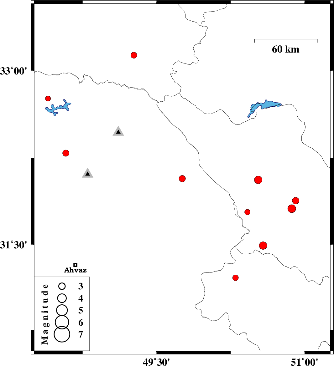
| Prel. Rep. | Date | Time(UTC) | Time(Local) | Lat. | Lon. | Depth | Mag. | Region | Waveform |
|
|
2014/12/12
|
22:14:05.7
|
01:44:05.7
| 32.07 | 49.76 | 14 |
ML:2.9
|
Khoozestan Province, 28 km North-West of Izeh | |
|
|
2014/12/12
|
03:30:03.1
|
07:00:03.1
| 32.06 | 50.53 | 44 |
ML:3.5
|
Chaharmahal Bakhtiari Province, 14 km West of Ardel | |
|
|
2014/12/10
|
07:59:03.2
|
11:29:03.2
| 31.49 | 50.58 | 14 |
ML:3.5
|
Chaharmahal Bakhtiari Province, 21 km West of Lordegan | |
|
|
2014/12/09
|
00:10:06.8
|
03:40:06.8
| 32.76 | 48.4 | 14 |
ML:2.4
|
Khoozestan Province, 34 km North of Andimeshk | |
|
|
2014/12/07
|
21:48:50.8
|
01:18:50.8
| 31.78 | 50.42 | 14 |
ML:2.6
|
Chaharmahal Bakhtiari Province, 32 km South-West of Ardel | |
|
|
2014/12/03
|
02:51:13.2
|
06:21:13.2
| 31.81 | 50.87 | 14 |
ML:3.6
|
Chaharmahal Bakhtiari Province, 35 km North of Lordegan | |
|
|
2014/11/27
|
11:04:28.4
|
14:34:28.4
| 33.13 | 49.27 | 16 |
ML:2.8
|
Lorestan Province, 41 km South-West of Azna | |
|
|
2014/11/19
|
21:18:19.6
|
00:48:19.6
| 32.29 | 48.58 | 16 |
ML:2.9
|
Khoozestan Province, 20 km East of Dezful | |
|
|
2014/11/19
|
10:11:52.4
|
13:41:52.4
| 31.88 | 50.91 | 14 |
ML:3.1
|
Chaharmahal Bakhtiari Province, 27 km South-East of Ardel | |
|
|
2014/11/12
|
22:49:53.2
|
02:19:53.2
| 31.21 | 50.3 | 14 |
ML:2.7
|
Kohkiluieh va boyerahmad Province, 68 km North of Behbahan | |
