
Magnitude |
:2.6 |
| Date & Time (UTC) | 2014-12-07 21:48:50.8 |
| Date & Time (Local) | 1393/9/17 01:18:50.8 |
| Location | Lat:31.78 Lon: 50.42 |
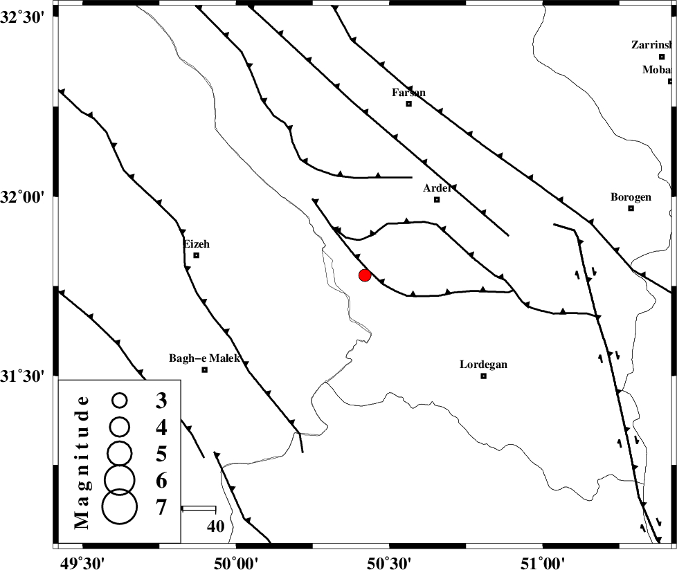
| Region | Chaharmahal Bakhtiari Province, 32 km South-West of Ardel |
Nearest Cities |
|
| 13 km North West of Sarkhun, Chaharmahal Bakhtiari Province | |
| 14 km North East of Dehdez, Khoozestan Province | |
| 24 km South West of Dupelan, Chaharmahal Bakhtiari Province | |
| 32 km South West of Ardel, Chaharmahal Bakhtiari Province | |
| 35 km South West of Naghan, Chaharmahal Bakhtiari Province | |
| Depth | 14 km |
| Agency | |
Faults within 150 km: |
|
| SABZKUH_F (Length: 67 km) , Distance to epicenter: 2 km | |
| DOPOLAN_F (Length: 107 km) , Distance to epicenter: 11 km | |
| ZARDKUH_F (Length: 139 km) , Distance to epicenter: 30 km | |
| Number of Phases | 6 |
| RMS | 0 |
| Number of Stations | 4 |
| Error in Latitude | >2.6 km |
| Error in Longitude | 3.3 km |
| Error in Depth | 4.8 km |
Download waveform in seisan format
to download seisan software Click here
to access information about IIEES stations Click here
Amplitude | ||||||||
| UID | Agency | Station | Component | Amplitude | Period | Arrival Time | Proccessing Time | Signal Clip |
| 94466 | IIEES | SHGR | N | 84.7 | 0.4 | 2014-12-07 21:49:39 | 2014-12-07 10:17:00 | n |
| 94467 | IIEES | SHGR | E | 87.2 | 0.44 | 2014-12-07 21:49:41 | 2014-12-07 10:17:00 | n |
Phase | ||||||||||||
| Agency | Station | Component | Phase Type | Phase Quality | First Motion | Observed Arrival Time | Time Residual | Loc. Flag | Input Weight | Distance | Azimuth | |
| IIEES | SHGR | Z | Pg | E | 2014-12-07 21:49:16 | -0.03 | y | 157 | 284 | |||
| IIEES | SHGR | N | Sg | E | 2014-12-07 21:49:35 | 0.03 | y | 157 | 284 | |||
| IIEES | KHMZ | Z | Pn | E | 2014-12-07 21:49:26 | 0.06 | y | 221 | 349 | |||
| IIEES | KHMZ | E | Sg | E | 2014-12-07 21:49:53 | -0.01 | y | 221 | 349 | |||
| IIEES | GHVR | Z | Pn | E | 2014-12-07 21:49:36 | 0 | y | 309 | 14 | |||
| IIEES | SNGE | Z | Pn | E | 2014-12-07 21:49:56 | -0.08 | y | 465 | 323 | |||