
| Prel. Rep. | Date | Time(UTC) | Time(Local) | Lat. | Lon. | Depth | Mag. | Region | Waveform |
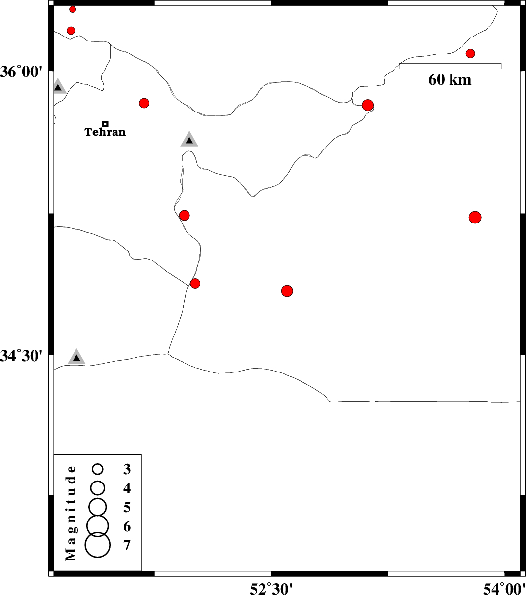
| 2014/04/14 | 16:26:10.9 | 20:56:10.9 | 34.84 | 52.6 | 15 | ML:3.3 | Semnan Province, 49 km South-East of Garmsar | ||
| 2014/04/14 | 15:45:14.1 | 20:15:14.1 | 34.88 | 52.01 | 29 | ML:2.8 | Semnan Province, 48 km South-West of Garmsar | ||
| 2014/04/13 | 06:08:46.5 | 10:38:46.5 | 35.83 | 51.68 | 15 | ML:2.8 | Tehran Province, 22 km East of Tajrish | ||
| 2014/04/10 | 17:24:02.0 | 21:54:02.0 | 36.09 | 53.78 | 42 | ML:2.6 | Semnan Province, 52 km West of Damghan | ||
| 2014/04/08 | 17:38:04.0 | 22:08:04.0 | 35.82 | 53.12 | 14 | ML:3.3 | Tehran Province, 33 km South of Pol-E-Sefid | ||
| 2014/04/04 | 12:42:41.7 | 17:12:41.7 | 35.23 | 53.81 | 14 | ML:3.5 | Semnan Province, 53 km South-East of Semnan | ||
| 2014/03/30 | 15:40:33.6 | 20:10:33.6 | 35.24 | 51.94 | 6 | ML:3 | Semnan Province, 26 km East of Varamin | ||
| 2014/03/22 | 23:37:23.5 | 04:07:23.5 | 36.32 | 51.22 | 14 | ML:1.8 | Mazandaran Province, 42 km South-West of Chalus | ||
| 2014/03/17 | 15:43:37.2 | 19:13:37.2 | 36.21 | 51.21 | 18 | ML:2.2 | Mazandaran Province, 50 km North-West of Tajrish |