
Magnitude |
:2.6 |
| Date & Time (UTC) | 2014-04-10 17:24:02.0 |
| Date & Time (Local) | 1393/1/21 21:54:02.0 |
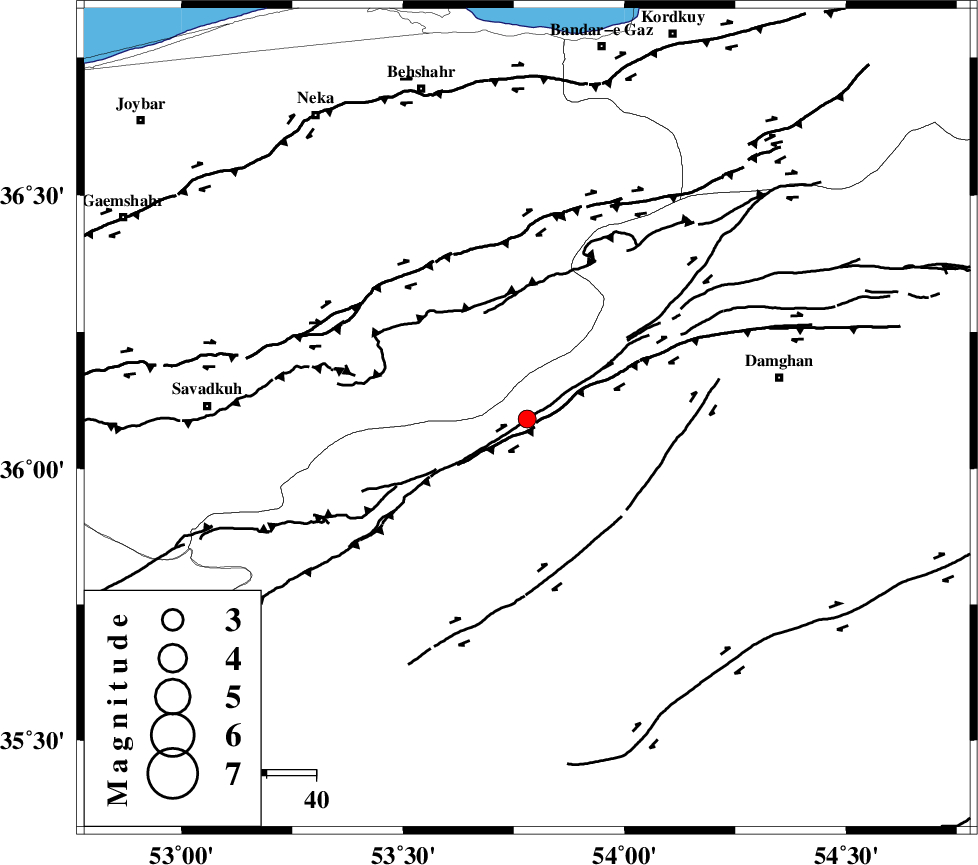
| Location | Lat:36.09 Lon: 53.78 |
| Region | Semnan Province, 52 km West of Damghan |
Nearest Cities |
|
| 15 km South of Talma darreh, Mazandaran Province | |
| 16 km North West of Darvar, Semnan Province | |
| 27 km South East of Kiasar, Mazandaran Province | |
| 33 km North West of Seydabad, Semnan Province | |
| 34 km North West of Amirabad, Semnan Province | |
| Depth | 42 km |
| Agency | |
Faults within 150 km: |
|
| DAMGHAN_F (Length: 95 km) , Distance to epicenter: 8 km | |
| ATARI_F (Length: 185 km) , Distance to epicenter: 20 km | |
| ASTANEH_F (Length: 72 km) , Distance to epicenter: 25 km | |
| Number of Phases | 6 |
| RMS | 0.2 |
| Number of Stations | 4 |
| Error in Latitude | >8.5 km |
| Error in Longitude | 2.7 km |
| Error in Depth | 4.6 km |
Download waveform in seisan format
to download seisan software Click here
to access information about IIEES stations Click here
Amplitude | ||||||||
| UID | Agency | Station | Component | Amplitude | Period | Arrival Time | Proccessing Time | Signal Clip |
| 92186 | IIEES | DAMV | E | 70.1 | 0.48 | 2014-04-10 17:24:55 | 2014-04-10 07:14:00 | n |
Phase | ||||||||||||
| Agency | Station | Component | Phase Type | Phase Quality | First Motion | Observed Arrival Time | Time Residual | Loc. Flag | Input Weight | Distance | Azimuth | |
| IIEES | DAMV | Z | Pn | E | 2014-04-10 17:24:28 | -0.16 | y | 171 | 253 | |||
| IIEES | DAMV | E | Sg | E | 2014-04-10 17:24:50 | -0.03 | y | 171 | 253 | |||
| IIEES | SHRO | E | Pn | E | 2014-04-10 17:24:32 | -0.21 | y | 202 | 92 | |||
| IIEES | SHRO | E | Sg | E | 2014-04-10 17:24:58 | 0.1 | y | 202 | 92 | |||
| IIEES | GHVR | E | Sg | E | 2014-04-10 17:25:22 | -0.08 | y | 291 | 233 | |||
| IIEES | ASAO | Z | Pn | E | 2014-04-10 17:24:55 | 0.46 | y | 382 | 244 | |||