
Magnitude |
:2.8 |
| Date & Time (UTC) | 2014-04-13 06:08:46.5 |
| Date & Time (Local) | 1393/1/24 10:38:46.5 |
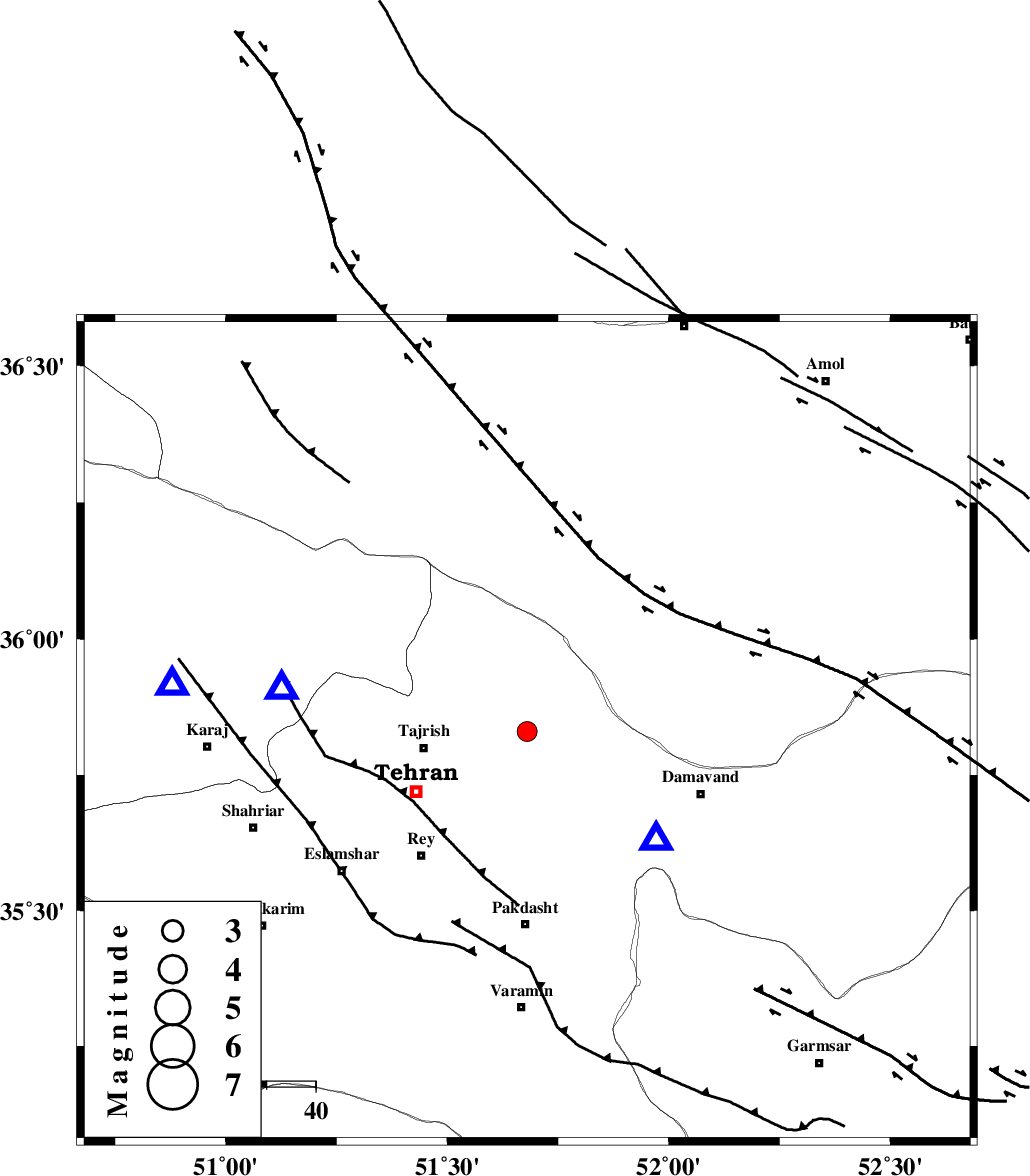
| Location | Lat:35.83 Lon: 51.68 |
| Region | Tehran Province, 22 km East of Tajrish |
Nearest Cities |
|
| 3 km of Afjeh, Tehran Province | |
| 5 km North of Lavasan, Tehran Province | |
| 18 km South East of Fasham, Tehran Province | |
| 20 km North West of Bumehen, Tehran Province | |
| 20 km North West of Rudehen, Tehran Province | |
| Depth | 15 km |
| Agency | |
Faults within 150 km: |
|
| MOSHA_F (Length: 234 km) , Distance to epicenter: 7 km | |
| N_TEHRAN_F4 (Length: 115 km) , Distance to epicenter: 9 km | |
| EYVANEKEY_F (Length: 74 km) , Distance to epicenter: 29 km | |
| Number of Phases | 4 |
| RMS | 0.3 |
| Number of Stations | 4 |
| Error in Latitude | >5 km |
| Error in Longitude | 4.1 km |
| Error in Depth | 6.9 km |
Download waveform in seisan format
to download seisan software Click here
to access information about IIEES stations Click here
Amplitude | ||||||||
| UID | Agency | Station | Component | Amplitude | Period | Arrival Time | Proccessing Time | Signal Clip |
| 92211 | IIEES | DAMV | E | 966.5 | 0.15 | 2014-04-13 06:08:59 | 2014-04-13 07:36:00 | n |
| 92212 | IIEES | THKV | E | 437.6 | 0.19 | 2014-04-13 06:09:10 | 2014-04-13 07:36:00 | n |
| 92213 | IIEES | GHVR | E | 141.2 | 0.41 | 2014-04-13 06:09:35 | 2014-04-13 07:36:00 | n |
Phase | ||||||||||||
| Agency | Station | Component | Phase Type | Phase Quality | First Motion | Observed Arrival Time | Time Residual | Loc. Flag | Input Weight | Distance | Azimuth | |
| IIEES | DAMV | Z | Pg | E | 2014-04-13 06:08:53 | -0.01 | y | 33.9 | 130 | |||
| IIEES | THKV | Z | Pg | E | 2014-04-13 06:08:59 | -0.13 | y | 73.4 | 278 | |||
| IIEES | GHVR | Z | Pg | E | 2014-04-13 06:09:11 | -0.32 | y | 155 | 195 | |||
| IIEES | KHMZ | Z | Pn | E | 2014-04-13 06:09:29 | 0.49 | y | 280 | 215 | |||