
Magnitude |
:3.5 |
| Date & Time (UTC) | 2014-04-04 12:42:41.7 |
| Date & Time (Local) | 1393/1/15 17:12:41.7 |
| Location | Lat:35.23 Lon: 53.81 |
| Region | Semnan Province, 53 km South-East of Semnan |
Nearest Cities |
|
| 45 km South East of Alae, Semnan Province | |
| 53 km South East of Semnan, Semnan Province | |
| 60 km South East of Sorkheh, Semnan Province | |
| 68 km South East of Mehdishahr, Semnan Province | |
| 69 km South East of Lasjerd, Semnan Province | |
| Depth | 14 km |
| Agency | |
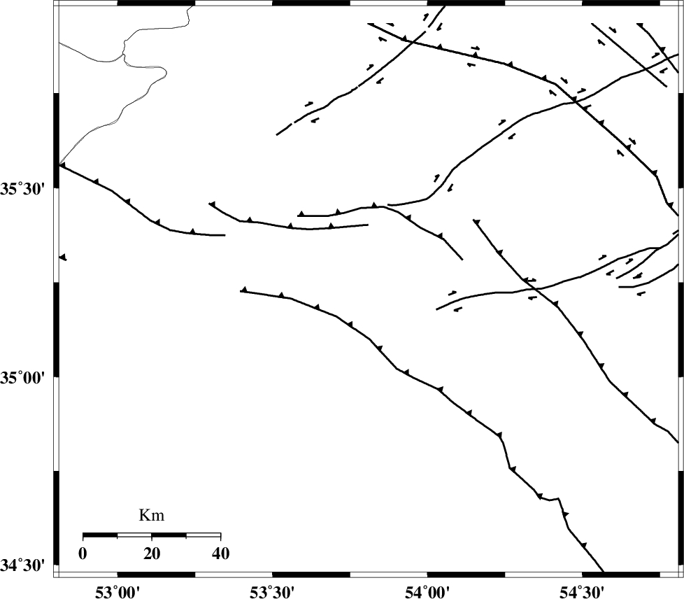
Faults within 150 km: |
|
| TORUD_F (Length: 136 km) , Distance to epicenter: 23 km | |
| KUH_E_GUGERD_F (Length: 73 km) , Distance to epicenter: 32 km | |
| KUH_E_GACHAB_F2 (Length: 31 km) , Distance to epicenter: 35 km | |
| Number of Phases | 5 |
| RMS | 0.1 |
| Number of Stations | 5 |
| Error in Latitude | >6.1 km |
| Error in Longitude | 2.8 km |
| Error in Depth | 11.4 km |
Download waveform in seisan format
to download seisan software Click here
to access information about IIEES stations Click here
Amplitude | ||||||||
| UID | Agency | Station | Component | Amplitude | Period | Arrival Time | Proccessing Time | Signal Clip |
| 92146 | IIEES | GHVR | E | 322.2 | 0.4 | 2014-04-04 12:43:56 | 2014-04-04 02:08:00 | n |
Phase | ||||||||||||
| Agency | Station | Component | Phase Type | Phase Quality | First Motion | Observed Arrival Time | Time Residual | Loc. Flag | Input Weight | Distance | Azimuth | |
| IIEES | SHRO | E | Pg | E | 2014-04-04 12:43:17 | -0.04 | y | 218 | 66 | |||
| IIEES | GHVR | Z | Pn | E | 2014-04-04 12:43:20 | 0 | y | 248 | 251 | |||
| IIEES | YZKH | Z | Pn | E | 2014-04-04 12:43:29 | -0.08 | y | 323 | 167 | |||
| IIEES | TABS | Z | Pn | E | 2014-04-04 12:43:33 | 0.1 | y | 351 | 119 | |||
| IIEES | ASAO | Z | Pn | E | 2014-04-04 12:43:33 | 0.02 | y | 354 | 259 | |||