
| Prel. Rep. | Date | Time(UTC) | Time(Local) | Lat. | Lon. | Depth | Mag. | Region | Waveform |
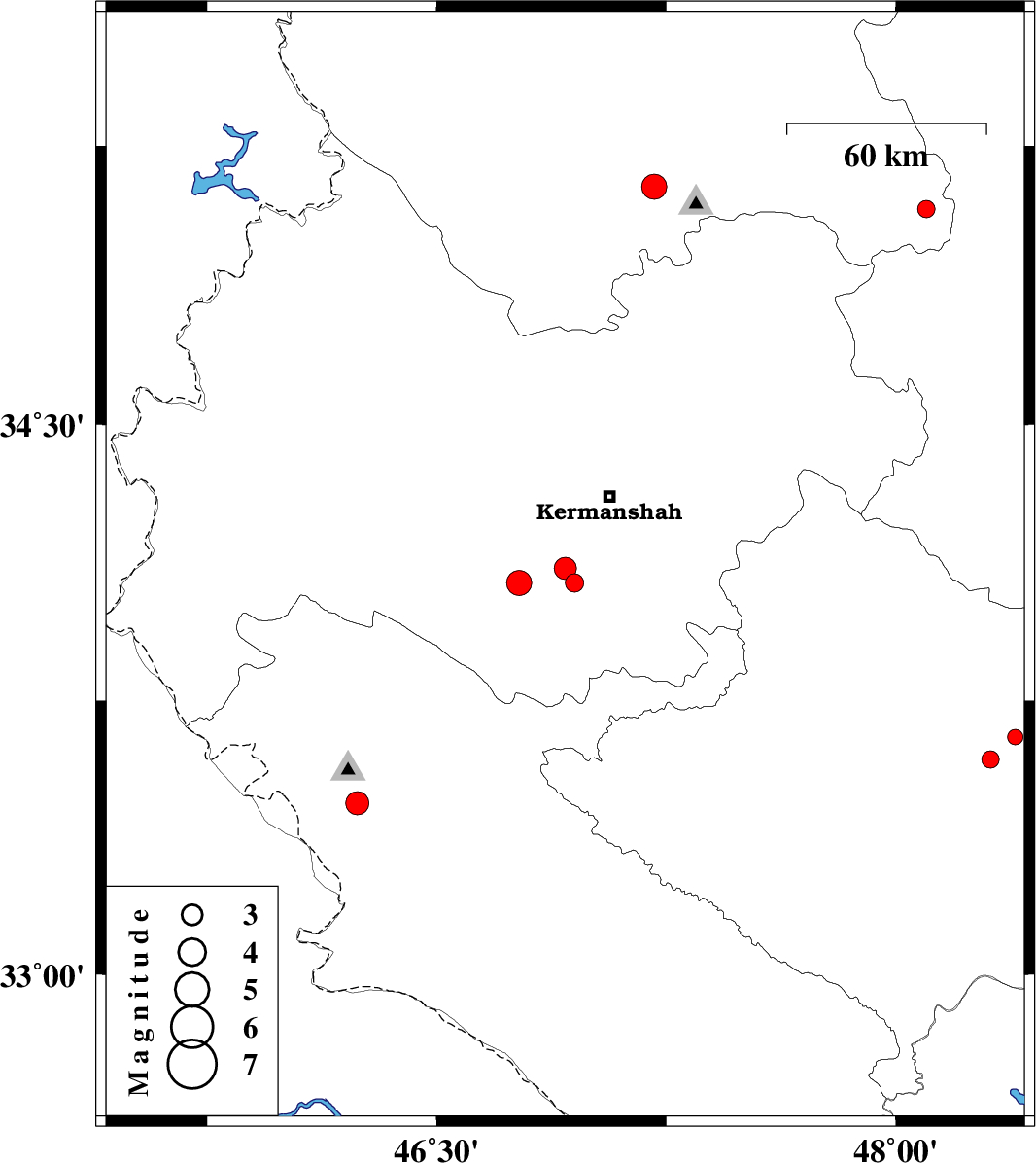
| 2012/11/20 | 15:19:38.3 | 18:49:38.3 | 34.07 | 46.95 | 14 | ML:2.7 | Kermanshah Province, 29 km South-West of Kermanshah | ||
| 2012/11/20 | 10:05:05.7 | 13:35:05.7 | 34.11 | 46.92 | 15 | ML:3.2 | Kermanshah Province, 30 km East of Eslam Abad-E-Gharb | ||
| 2012/11/19 | 14:11:24.8 | 17:41:24.8 | 34.07 | 46.77 | 37 | ML:3.7 | Kermanshah Province, 16 km East of Eslam Abad-E-Gharb | ||
| 2012/11/10 | 16:17:30.0 | 19:47:30.0 | 33.59 | 48.31 | 18 | ML:2.5 | Lorestan Province, 12 km North of Khorramabad | ||
| 2012/11/09 | 23:55:52.5 | 03:25:52.5 | 33.65 | 48.39 | 18 | ML:2.2 | Lorestan Province, 19 km North of Khorramabad | ||
| 2012/11/08 | 19:53:13.4 | 23:23:13.4 | 35.08 | 48.1 | 14 | ML:2.5 | Kurdistan Province, 34 km North of Asad Abad | ||
| 2012/10/28 | 02:21:07.7 | 05:51:07.7 | 35.14 | 47.21 | 14 | ML:3.6 | Kurdistan Province, 28 km South-East of Sanandaj | ||
| 2012/10/23 | 11:56:40.1 | 15:26:40.1 | 33.47 | 46.24 | 14 | ML:3.4 | Ilam Province, 26 km South-West of Ilam |