
Magnitude |
:2.5 |
| Date & Time (UTC) | 2012-11-10 16:17:30.0 |
| Date & Time (Local) | 1391/8/20 19:47:30.0 |
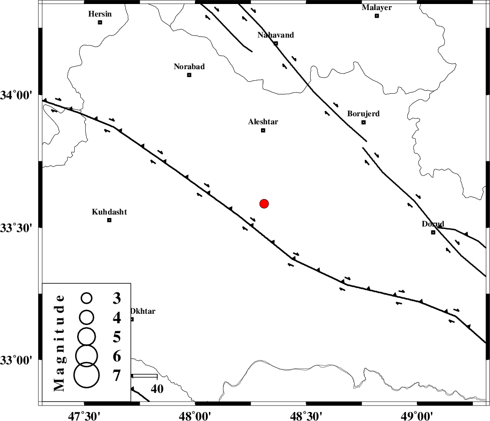
| Location | Lat:33.59 Lon: 48.31 |
| Region | Lorestan Province, 12 km North of Khorramabad |
Nearest Cities |
|
| 4 km of Rebat namaki, Lorestan Province | |
| 13 km North of Khorramabad, Lorestan Province | |
| 16 km North of Badrabad-e sofla, Lorestan Province | |
| 20 km North West of Kamalvand-e gholamali, Lorestan Province | |
| 21 km North East of Godar-e mahmudvand, Lorestan Province | |
| Depth | 18 km |
| Agency | |
Faults within 150 km: |
|
| HZF4 (Length: 492 km) , Distance to epicenter: 12 km | |
| DORUD (Length: 100 km) , Distance to epicenter: 47 km | |
| NAHAVAND_F (Length: 102 km) , Distance to epicenter: 48 km | |
| Number of Phases | 5 |
| RMS | 0.1 |
| Number of Stations | 3 |
| Error in Latitude | >4.7 km |
| Error in Longitude | 2.8 km |
| Error in Depth | 5.4 km |
Download waveform in seisan format
to download seisan software Click here
to access information about IIEES stations Click here
Amplitude | ||||||||
| UID | Agency | Station | Component | Amplitude | Period | Arrival Time | Proccessing Time | Signal Clip |
| 86962 | IIEES | KHMZ | N | 53 | 0.4 | 2012-11-10 16:18:24 | 2012-11-10 04:53:00 | n |
| 86963 | IIEES | KHMZ | E | 62.1 | 0.56 | 2012-11-10 16:18:25 | 2012-11-10 04:53:00 | n |
| 86964 | IIEES | GHVR | E | 19.8 | 0.52 | 2012-11-10 16:18:55 | 2012-11-10 04:53:00 | n |
| 86965 | IIEES | GHVR | N | 22.6 | 0.48 | 2012-11-10 16:18:55 | 2012-11-10 04:53:00 | n |
Phase | ||||||||||||
| Agency | Station | Component | Phase Type | Phase Quality | First Motion | Observed Arrival Time | Time Residual | Loc. Flag | Input Weight | Distance | Azimuth | |
| IIEES | KHMZ | Z | Pg | E | 2012-11-10 16:17:55 | 0.09 | y | 154 | 83 | |||
| IIEES | KHMZ | N | Sg | E | 2012-11-10 16:18:14 | -0.07 | y | 154 | 83 | |||
| IIEES | SNGE | Z | Pn | E | 2012-11-10 16:18:00 | -0.01 | y | 189 | 332 | |||
| IIEES | GHVR | Z | Pn | E | 2012-11-10 16:18:13 | -0.06 | y | 288 | 69 | |||
| IIEES | GHVR | N | Sg | E | 2012-11-10 16:18:51 | 0.04 | y | 288 | 69 | |||