| Prel. Rep. | Date | Time(UTC) | Time(Local) | Lat. | Lon. | Depth | Mag. | Region | Waveform |
|
|
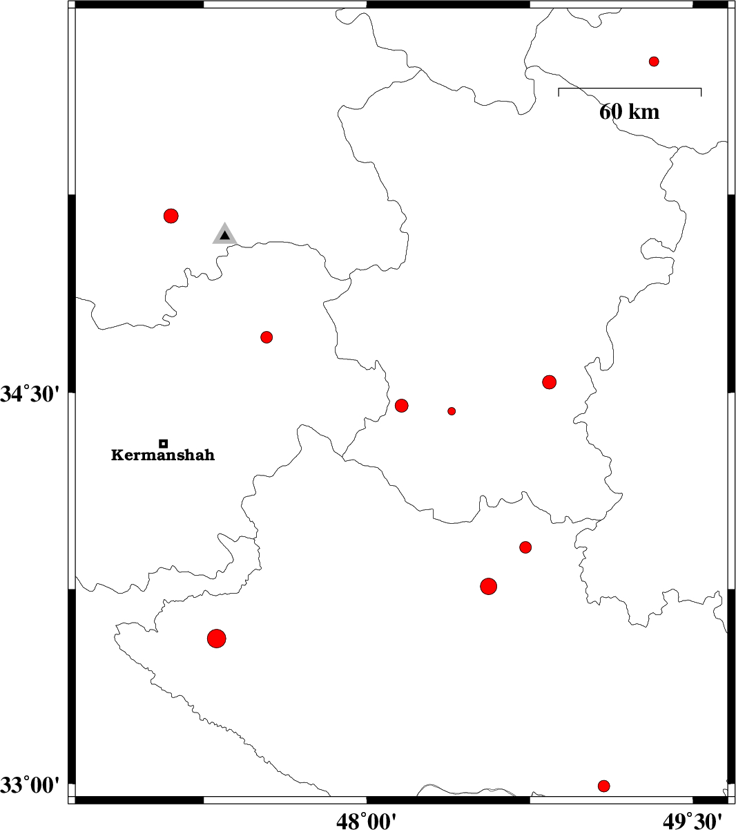
2012/09/22
|
03:52:39.6
|
07:22:39.6
| 34.45 | 48.16 | 31 |
ML:2.7
|
Hamedan Province, 21 km East of Kangavar | |
|
|
2012/09/19
|
11:59:40.4
|
16:29:40.4
| 33.56 | 47.31 | 14 |
ML:3.8
|
Lorestan Province, 28 km West of Kuhdasht | |
|
|
2012/09/18
|
02:41:51.8
|
07:11:51.8
| 34.43 | 48.39 | 38 |
ML:1.6
|
Hamedan Province, 15 km South of Tuyserkan | |
|
|
2012/09/10
|
15:50:18.2
|
20:20:18.2
| 34.71 | 47.54 | 15 |
ML:2.4
|
Kermanshah Province, 10 km Sonqor | |
|
|
2012/09/03
|
04:12:50.2
|
08:42:50.2
| 35.17 | 47.1 | 14 |
ML:3
|
Kordestan Province, 19 km South-East of Sanandaj | |
|
|
2012/08/30
|
20:10:36.7
|
00:40:36.7
| 35.75 | 49.32 | 14 |
ML:2
|
Ghazvin Province, 44 km South of Abhar | |
|
|
2012/08/30
|
13:37:52.4
|
18:07:52.4
| 34.54 | 48.84 | 32 |
ML:2.8
|
Hamedan Province, 27 km North of Malayer | |
|
|
2012/08/28
|
00:15:42.4
|
04:45:42.4
| 32.99 | 49.09 | 15 |
ML:2.4
|
Lorestan Province, 54 km South of Dorud | |
|
|
2012/08/24
|
13:29:55.3
|
17:59:55.3
| 33.76 | 48.56 | 16 |
ML:3.4
|
Lorestan Province, 24 km South-West of Borujerd | |
|
|
2012/08/23
|
04:59:52.0
|
09:29:52.0
| 33.91 | 48.73 | 14 |
ML:2.4
|
Lorestan Province, 3 km Borujerd | |