
Magnitude |
:2.4 |
| Date & Time (UTC) | 2012-08-23 04:59:52.0 |
| Date & Time (Local) | 1391/6/2 09:29:52.0 |
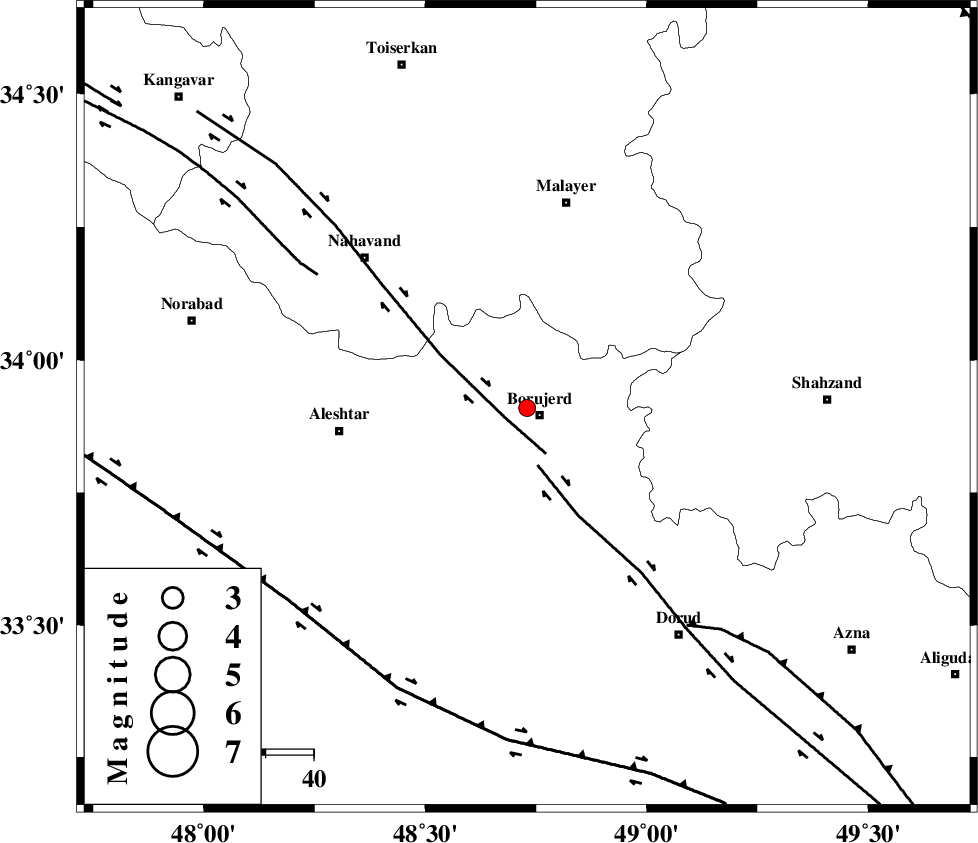
| Location | Lat:33.91 Lon: 48.73 |
| Region | Lorestan Province, 3 km Borujerd |
Nearest Cities |
|
| 3 km North of Borujerd, Lorestan Province | |
| 9 km of Bon dizeh, Lorestan Province | |
| 10 km North of Hemmatabad, Lorestan Province | |
| 11 km North West of Valanjerd, Lorestan Province | |
| 14 km South of Ashtarinan, Lorestan Province | |
| Depth | 14 km |
| Agency | |
Faults within 150 km: |
|
| NAHAVAND_F (Length: 102 km) , Distance to epicenter: 5 km | |
| DORUD (Length: 100 km) , Distance to epicenter: 12 km | |
| SAHANEH_F (Length: 77 km) , Distance to epicenter: 52 km | |
| Number of Phases | 4 |
| RMS | 0.1 |
| Number of Stations | 4 |
| Error in Latitude | >6.7 km |
| Error in Longitude | 3.9 km |
| Error in Depth | 5.6 km |
Download waveform in seisan format
to download seisan software Click here
to access information about IIEES stations Click here
Amplitude | ||||||||
| UID | Agency | Station | Component | Amplitude | Period | Arrival Time | Proccessing Time | Signal Clip |
| 85706 | IIEES | KHMZ | E | 85.2 | 0.48 | 2012-08-23 05:00:32 | 2012-08-23 05:36:00 | n |
| 85707 | IIEES | SNGE | N | 44.2 | 0.44 | 2012-08-23 05:00:51 | 2012-08-23 05:36:00 | n |
| 85708 | IIEES | GHVR | E | 27.4 | 0.44 | 2012-08-23 05:01:09 | 2012-08-23 05:36:00 | n |
Phase | ||||||||||||
| Agency | Station | Component | Phase Type | Phase Quality | First Motion | Observed Arrival Time | Time Residual | Loc. Flag | Input Weight | Distance | Azimuth | |
| IIEES | KHMZ | Z | Pg | E | 2012-08-23 05:00:11 | -0.11 | y | 116 | 99 | |||
| IIEES | ASAO | Z | Pg | E | 2012-08-23 05:00:15 | -0.09 | y | 139 | 59 | |||
| IIEES | SNGE | Z | Pg | E | 2012-08-23 05:00:22 | -0.02 | y | 183 | 316 | |||
| IIEES | GHVR | Z | Pn | E | 2012-08-23 05:00:29 | 0.23 | y | 241 | 74 | |||