
Magnitude |
:2.8 |
| Date & Time (UTC) | 2012-08-30 13:37:52.4 |
| Date & Time (Local) | 1391/6/9 18:07:52.4 |
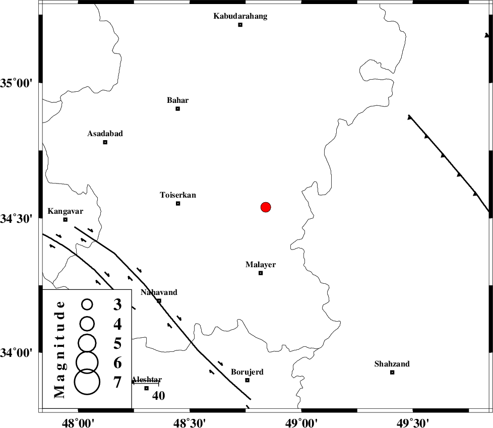
| Location | Lat:34.54 Lon: 48.84 |
| Region | Hamedan Province, 27 km North of Malayer |
Nearest Cities |
|
| 9 km West of Eslamabad, Hamedan Province | |
| 17 km South East of Gonbad, Hamedan Province | |
| 19 km North East of Jokar, Hamedan Province | |
| 22 km South West of Void, Hamedan Province | |
| 25 km North of Mehrabad, Hamedan Province | |
| Depth | 32 km |
| Agency | |
Faults within 150 km: |
|
| NAHAVAND_F (Length: 102 km) , Distance to epicenter: 59 km | |
| SAHANEH_F (Length: 77 km) , Distance to epicenter: 68 km | |
| TAFRESH_F (Length: 117 km) , Distance to epicenter: 70 km | |
| Number of Phases | 5 |
| RMS | 0.3 |
| Number of Stations | 3 |
| Error in Latitude | >7.3 km |
| Error in Longitude | 5.4 km |
| Error in Depth | 8 km |
Download waveform in seisan format
to download seisan software Click here
to access information about IIEES stations Click here
Amplitude | ||||||||
| UID | Agency | Station | Component | Amplitude | Period | Arrival Time | Proccessing Time | Signal Clip |
| 85867 | IIEES | KHMZ | N | 91.8 | 0.28 | 2012-08-30 13:38:33 | 2012-08-30 01:47:00 | n |
| 85868 | IIEES | SNGE | N | 214.4 | 0.28 | 2012-08-30 13:38:36 | 2012-08-30 01:47:00 | n |
| 85869 | IIEES | SNGE | E | 209.7 | 0.16 | 2012-08-30 13:38:37 | 2012-08-30 01:47:00 | n |
Phase | ||||||||||||
| Agency | Station | Component | Phase Type | Phase Quality | First Motion | Observed Arrival Time | Time Residual | Loc. Flag | Input Weight | Distance | Azimuth | |
| IIEES | ASAO | Z | Pg | E | 2012-08-30 13:38:10 | -0.06 | y | 109 | 89 | |||
| IIEES | KHMZ | Z | Pg | E | 2012-08-30 13:38:15 | 0.55 | y | 136 | 130 | |||
| IIEES | KHMZ | N | Sg | E | 2012-08-30 13:38:31 | -0.38 | y | 136 | 130 | |||
| IIEES | SNGE | Z | Pn | E | 2012-08-30 13:38:17 | -0.06 | y | 150 | 295 | |||
| IIEES | SNGE | N | Sg | E | 2012-08-30 13:38:35 | -0.05 | y | 150 | 295 | |||