
Magnitude |
:3 |
| Date & Time (UTC) | 2012-09-03 04:12:50.2 |
| Date & Time (Local) | 1391/6/13 08:42:50.2 |
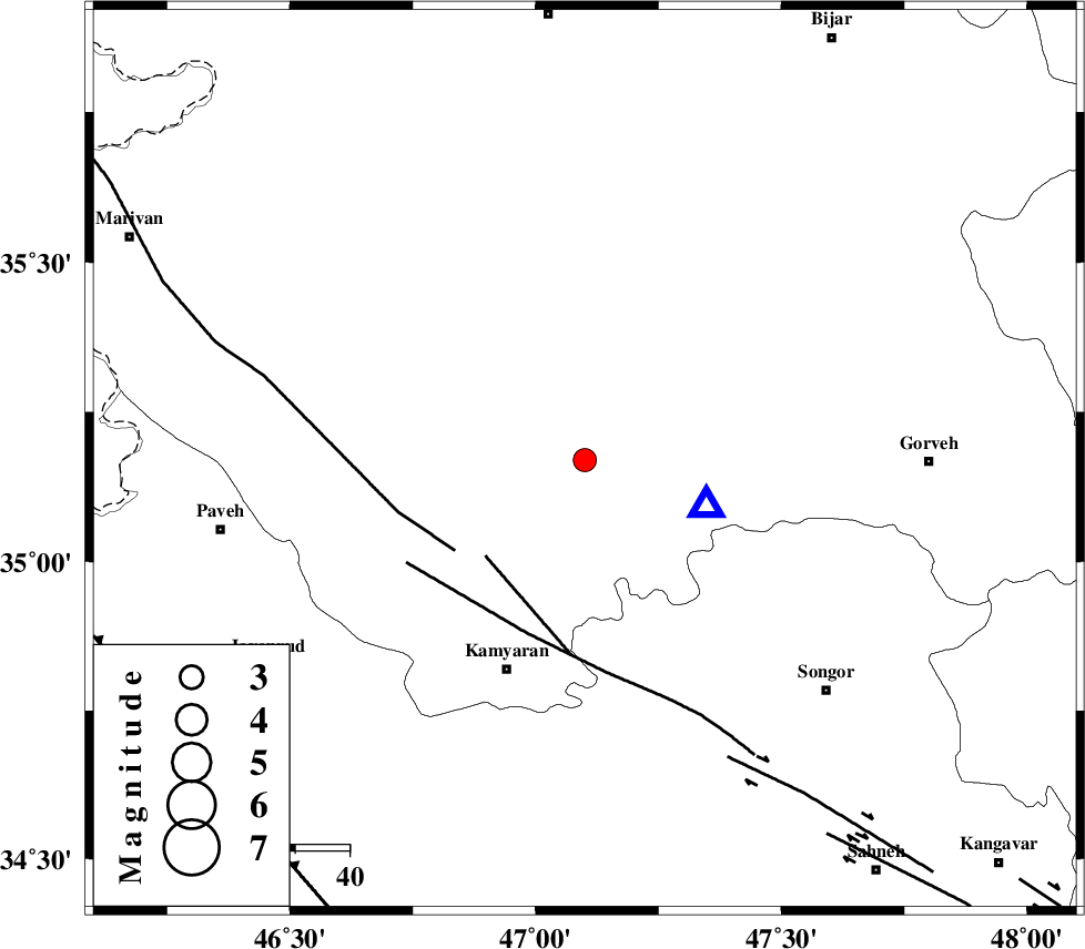
| Location | Lat:35.17 Lon: 47.1 |
| Region | Kordestan Province, 19 km South-East of Sanandaj |
Nearest Cities |
|
| 10 km North of Muchesh, Kurdistan Province | |
| 14 km of Gorizeh, Kurdistan Province | |
| 14 km North East of Ali Abad, Kurdistan Province | |
| 17 km South of Salavatabad, Kurdistan Province | |
| 19 km South East of Sanandaj, Kurdistan Province | |
| Depth | 14 km |
| Agency | |
Faults within 150 km: |
|
| MORVARID_F (Length: 24 km) , Distance to epicenter: 26 km | |
| PIRANSHAHR_F (Length: 253 km) , Distance to epicenter: 29 km | |
| SARTAKHT_F (Length: 78 km) , Distance to epicenter: 34 km | |
| Number of Phases | 6 |
| RMS | 0.2 |
| Number of Stations | 5 |
| Error in Latitude | >4.8 km |
| Error in Longitude | 8.9 km |
| Error in Depth | 3.7 km |
Download waveform in seisan format
to download seisan software Click here
to access information about IIEES stations Click here
Amplitude | ||||||||
| UID | Agency | Station | Component | Amplitude | Period | Arrival Time | Proccessing Time | Signal Clip |
| 85936 | IIEES | SNGE | N | 4236.2 | 0.38 | 2012-09-03 04:13:08 | 2012-09-03 04:45:00 | n |
| 85937 | IIEES | KHMZ | E | 61.3 | 0.45 | 2012-09-03 04:14:34 | 2012-09-03 04:45:00 | n |
| 85938 | IIEES | KHMZ | N | 42.3 | 0.4 | 2012-09-03 04:14:36 | 2012-09-03 04:45:00 | n |
Phase | ||||||||||||
| Agency | Station | Component | Phase Type | Phase Quality | First Motion | Observed Arrival Time | Time Residual | Loc. Flag | Input Weight | Distance | Azimuth | |
| IIEES | SNGE | Z | Pg | E | 2012-09-03 04:12:55 | -0.03 | y | 24.2 | 110 | |||
| IIEES | ZNJK | Z | Pn | E | 2012-09-03 04:13:25 | -0.17 | y | 220 | 40 | |||
| IIEES | ASAO | Z | Pn | E | 2012-09-03 04:13:32 | 0.21 | y | 276 | 104 | |||
| IIEES | KHMZ | Z | Pn | E | 2012-09-03 04:13:36 | -0.11 | y | 307 | 120 | |||
| IIEES | KHMZ | E | Sg | E | 2012-09-03 04:14:16 | -0.07 | y | 307 | 120 | |||
| IIEES | CHTH | Z | Pn | E | 2012-09-03 04:13:44 | 0.2 | y | 374 | 76 | |||