
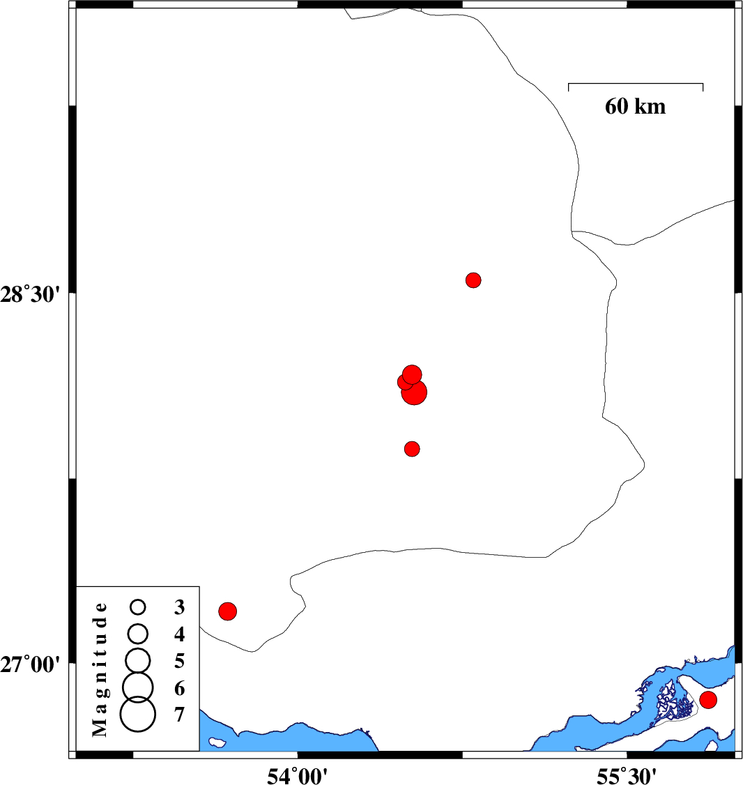
| Prel. Rep. | Date | Time(UTC) | Time(Local) | Lat. | Lon. | Depth | Mag. | Region | Waveform |
| 2011/10/19 | 03:10:20.0 | 06:40:20.0 | 28.17 | 54.52 | 14 | ML:3.9 | Fars Province, 64 km South of Darab | ||
| 2011/10/19 | 03:04:44.2 | 06:34:44.2 | 28.14 | 54.49 | 18 | ML:3.3 | Fars Province, 53 km North-East of Lar | ||
| 2011/10/19 | 02:52:40.2 | 06:22:40.2 | 28.1 | 54.53 | 18 | ML:5.2 | Fars Province, 50 km North-East of Lar | ||
| 2011/10/12 | 20:05:02.3 | 23:35:02.3 | 27.87 | 54.52 | 15 | ML:3.1 | Fars Province, 28 km North-East of Lar | ||
| 2011/10/08 | 01:58:28.8 | 05:28:28.8 | 28.55 | 54.8 | 18 | ML:3.1 | Fars Province, 34 km South-East of Darab | ||
| 2011/09/23 | 22:12:37.4 | 01:42:37.4 | 26.85 | 55.87 | 18 | ML:3.5 | Persian Gulf, 41 km South-West of Qeshm | ||
| 2011/09/20 | 20:23:42.3 | 00:53:42.3 | 27.21 | 53.68 | 29 | ML:3.6 | Fars Province, 53 km South-East of Lamerd |