
Magnitude |
:3.6 |
| Date & Time (UTC) | 2011-09-20 20:23:42.3 |
| Date & Time (Local) | 1390/6/30 00:53:42.3 |
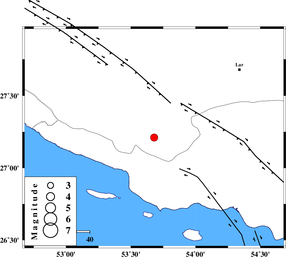
| Location | Lat:27.21 Lon: 53.68 |
| Region | Fars Province, 53 km South-East of Lamerd |
Nearest Cities |
|
| 7 km of Ashkenan, Fars Province | |
| 7 km North of Ahl, Fars Province | |
| 29 km South East of Beyram, Fars Province | |
| 45 km South East of Fedagh, Fars Province | |
| 47 km South West of Bagh, Fars Province | |
| Depth | 29 km |
| Agency | |
Faults within 150 km: |
|
| MFF3 (Length: 292 km) , Distance to epicenter: 17 km | |
| MFF1 (Length: 180 km) , Distance to epicenter: 39 km | |
| LAR_F (Length: 99 km) , Distance to epicenter: 53 km | |
| Number of Phases | 4 |
| RMS | 0 |
| Number of Stations | 3 |
| Error in Latitude | >7.9 km |
| Error in Longitude | 6.3 km |
| Error in Depth | 4.6 km |
Download waveform in seisan format
to download seisan software Click here
to access information about IIEES stations Click here
Amplitude | ||||||||
| UID | Agency | Station | Component | Amplitude | Period | Arrival Time | Proccessing Time | Signal Clip |
| 80290 | IIEES | GHIR | E | 2333.9 | 0.9 | 2011-09-20 20:24:29 | 2011-09-23 04:21:00 | n |
| 80291 | IIEES | BNDS | E | 189.9 | 0.87 | 2011-09-20 20:25:07 | 2011-09-23 04:21:00 | n |
| 80292 | IIEES | BNDS | N | 252.2 | 0.72 | 2011-09-20 20:25:07 | 2011-09-23 04:21:00 | n |
Phase | ||||||||||||
| Agency | Station | Component | Phase Type | Phase Quality | First Motion | Observed Arrival Time | Time Residual | Loc. Flag | Input Weight | Distance | Azimuth | |
| IIEES | GHIR | Z | Pg | E | 2011-09-20 20:24:05 | 0 | y | 138 | 330 | |||
| IIEES | GHIR | E | Sg | E | 2011-09-20 20:24:21 | 0 | y | 138 | 330 | |||
| IIEES | BNDS | Z | Pg | E | 2011-09-20 20:24:21 | 0 | y | 247 | 84 | |||
| IIEES | NASN | Z | Pn | E | 2011-09-20 20:25:06 | 0 | y | 626 | 352 | |||