
Magnitude |
:5.2 |
| Date & Time (UTC) | 2011-10-19 02:52:40.2 |
| Date & Time (Local) | 1390/7/27 06:22:40.2 |
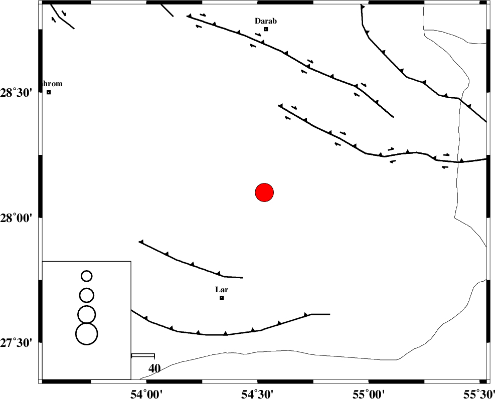
| Location | Lat:28.1 Lon: 54.53 |
| Region | Fars Province, 50 km North-East of Lar |
Nearest Cities |
|
| 30 km North East of Dehkuyeh, Fars Province | |
| 30 km South East of Shahr-e pir, Fars Province | |
| 31 km South East of Hajiabad, Fars Province | |
| 47 km North East of Latifi, Fars Province | |
| 47 km South East of Dabiran, Fars Province | |
| Depth | 18 km |
| Agency | |
Faults within 150 km: |
|
| HZF2 (Length: 437 km) , Distance to epicenter: 37 km | |
| BERIZ_F (Length: 49 km) , Distance to epicenter: 39 km | |
| LAR_F (Length: 99 km) , Distance to epicenter: 58 km | |
| Number of Phases | 8 |
| RMS | 0.1 |
| Number of Stations | 6 |
| Error in Latitude | >2.8 km |
| Error in Longitude | 1.3 km |
| Error in Depth | 3.5 km |
Download waveform in seisan format
to download seisan software Click here
to access information about IIEES stations Click here
Amplitude | ||||||||
| UID | Agency | Station | Component | Amplitude | Period | Arrival Time | Proccessing Time | Signal Clip |
| 80481 | IIEES | GHIR | E | 68139.6 | 0.48 | 2011-10-19 02:53:28 | 2011-10-19 01:05:00 | n |
| 80482 | IIEES | AHRM | N | 4840.8 | 0.52 | 2011-10-19 02:54:23 | 2011-10-19 01:05:00 | n |
Phase | ||||||||||||
| Agency | Station | Component | Phase Type | Phase Quality | First Motion | Observed Arrival Time | Time Residual | Loc. Flag | Input Weight | Distance | Azimuth | |
| IIEES | GHIR | Z | Pg | E | 2011-10-19 02:53:05 | -0.01 | y | 153 | 278 | |||
| IIEES | GHIR | E | Sg | E | 2011-10-19 02:53:24 | 0.05 | y | 153 | 278 | |||
| IIEES | AHRM | Z | Pn | E | 2011-10-19 02:53:28 | -0.03 | y | 327 | 286 | |||
| IIEES | NASN | Z | Pn | E | 2011-10-19 02:53:55 | -0.1 | y | 547 | 343 | |||
| IIEES | CHBR | Z | Pn | E | 2011-10-19 02:54:08 | -0.04 | y | 654 | 114 | |||
| IIEES | CHBR | E | Sg | E | 2011-10-19 02:55:41 | 0.03 | y | 654 | 114 | |||
| IIEES | TABS | Z | Pn | E | 2011-10-19 02:54:10 | 0.16 | y | 663 | 21 | |||
| IIEES | BJRD | Z | Pn | E | 2011-10-19 02:55:03 | -0.09 | y | 1099 | 13 | |||