
| Prel. Rep. | Date | Time(UTC) | Time(Local) | Lat. | Lon. | Depth | Mag. | Region | Waveform |
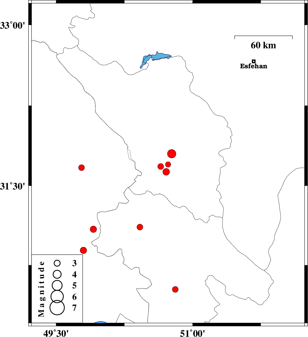
| 2011/08/31 | 12:40:14.9 | 17:10:14.9 | 31.7 | 50.73 | 14 | ML:2.7 | Chaharmahal Bakhtiari Province, 24 km North of Lordegan | ||
| 2011/08/23 | 13:46:44.1 | 18:16:44.1 | 31.63 | 50.71 | 14 | ML:3.4 | Chaharmahal Bakhtiari Province, 17 km North-West of Lordegan | ||
| 2011/08/23 | 09:43:07.3 | 14:13:07.3 | 31.68 | 50.65 | 18 | ML:2.9 | Chaharmahal Bakhtiari Province, 34 km South of Ardel | ||
| 2011/08/22 | 10:32:00.5 | 15:02:00.5 | 31.67 | 49.78 | 14 | ML:2.9 | Khoozestan Province, 21 km South of Izeh | ||
| 2011/08/14 | 17:26:41.8 | 21:56:41.8 | 31.11 | 50.42 | 18 | ML:2.9 | Kohkiluieh va boyerahmad Province, 38 km North-West of Dehdasht | ||
| 2011/08/07 | 08:31:16.3 | 13:01:16.3 | 30.89 | 49.8 | 30 | ML:3.3 | Khoozestan Province, 17 km North of Omidiyeh | ||
| 2011/08/06 | 23:11:04.2 | 03:41:04.2 | 30.52 | 50.81 | 18 | ML:3 | Kohkiluieh va boyerahmad Province, 19 km North of Dogonbadan | ||
| 2011/08/04 | 01:54:37.6 | 06:24:37.6 | 31.09 | 49.91 | 14 | ML:3.2 | Khoozestan Province, 47 km South of Bagh Malek | ||
| 2011/08/02 | 22:09:44.9 | 02:39:44.9 | 31.8 | 50.77 | 14 | ML:4.3 | Chaharmahal Bakhtiari Province, 24 km South-East of Ardel |