
Magnitude |
:3 |
| Date & Time (UTC) | 2011-08-06 23:11:04.2 |
| Date & Time (Local) | 1390/5/16 03:41:04.2 |
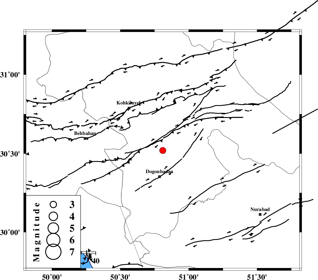
| Location | Lat:30.52 Lon: 50.81 |
| Region | Kohkiluieh va boyerahmad Province, 19 km North of Dogonbadan |
Nearest Cities |
|
| 19 km North of Dogonbadan, Kohkiluieh va boyerahmad Province | |
| 24 km North West of Abdehgah, Kohkiluieh va boyerahmad Province | |
| 38 km South East of Dehdasht, Kohkiluieh va boyerahmad Province | |
| 38 km North West of Basht, Kohkiluieh va boyerahmad Province | |
| 42 km South of Savari, Kohkiluieh va boyerahmad Province | |
| Depth | 18 km |
| Agency | |
Faults within 150 km: |
|
| MISHAN_F (Length: 76 km) , Distance to epicenter: 8 km | |
| MFF4 (Length: 62 km) , Distance to epicenter: 58 km | |
| RAG_E_SEFID_F (Length: 84 km) , Distance to epicenter: 60 km | |
| Number of Phases | 4 |
| RMS | 0.1 |
| Number of Stations | 4 |
| Error in Latitude | >61.9 km |
| Error in Longitude | 18.3 km |
| Error in Depth | 25.1 km |
Download waveform in seisan format
to download seisan software Click here
to access information about IIEES stations Click here
Amplitude | ||||||||
| UID | Agency | Station | Component | Amplitude | Period | Arrival Time | Proccessing Time | Signal Clip |
| 79931 | IIEES | SHGR | N | 167 | 0.38 | 2011-08-06 23:12:23 | 2011-08-07 01:07:00 | n |
| 79932 | IIEES | SHGR | E | 117.2 | 0 | 2011-08-06 23:12:24 | 2011-08-07 01:07:00 | n |
| 79933 | IIEES | NASN | E | 20.8 | 0.12 | 2011-08-06 23:12:31 | 2011-08-07 01:07:00 | n |
Phase | ||||||||||||
| Agency | Station | Component | Phase Type | Phase Quality | First Motion | Observed Arrival Time | Time Residual | Loc. Flag | Input Weight | Distance | Azimuth | |
| IIEES | SHGR | Z | Pg | E | 2011-08-06 23:11:46 | 0.05 | y | 260 | 313 | |||
| IIEES | NASN | Z | Pn | E | 2011-08-06 23:11:51 | -0.01 | y | 316 | 36 | |||
| IIEES | KHMZ | Z | Pn | E | 2011-08-06 23:11:56 | -0.22 | y | 366 | 348 | |||
| IIEES | GHVR | Z | Pn | E | 2011-08-06 23:12:06 | 0.2 | y | 441 | 5 | |||