
Magnitude |
:3.4 |
| Date & Time (UTC) | 2011-08-23 13:46:44.1 |
| Date & Time (Local) | 1390/6/1 18:16:44.1 |
| Location | Lat:31.63 Lon: 50.71 |
| Region | Chaharmahal Bakhtiari Province, 17 km North-West of Lordegan |
Nearest Cities |
|
| 8 km of Armand-e olia, Chaharmahal Bakhtiari Province | |
| 17 km North of Lordegan, Chaharmahal Bakhtiari Province | |
| 20 km South East of Sarkhun, Chaharmahal Bakhtiari Province | |
| 31 km North West of Sardasht, Chaharmahal Bakhtiari Province | |
| 34 km South East of Dupelan, Chaharmahal Bakhtiari Province | |
| Depth | 14 km |
| Agency | |
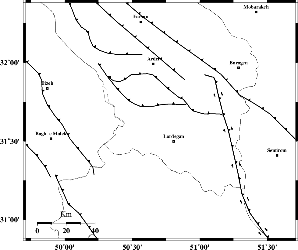
Faults within 150 km: |
|
| SABZKUH_F (Length: 67 km) , Distance to epicenter: 11 km | |
| DOPOLAN_F (Length: 107 km) , Distance to epicenter: 21 km | |
| ARDAL_F (Length: 170 km) , Distance to epicenter: 34 km | |
| Number of Phases | 8 |
| RMS | 0.2 |
| Number of Stations | 6 |
| Error in Latitude | >3.2 km |
| Error in Longitude | 2.8 km |
| Error in Depth | 8.3 km |
Download waveform in seisan format
to download seisan software Click here
to access information about IIEES stations Click here
Amplitude | ||||||||
| UID | Agency | Station | Component | Amplitude | Period | Arrival Time | Proccessing Time | Signal Clip |
| 80078 | IIEES | SHGR | E | 500.6 | 0.52 | 2011-08-23 13:47:44 | 2011-08-23 02:19:00 | n |
| 80079 | IIEES | SHGR | N | 612.6 | 0.36 | 2011-08-23 13:47:50 | 2011-08-23 02:19:00 | n |
| 80080 | IIEES | GHVR | E | 75.8 | 0.68 | 2011-08-23 13:48:30 | 2011-08-23 02:19:00 | n |
| 80081 | IIEES | GHVR | N | 84 | 0.6 | 2011-08-23 13:48:31 | 2011-08-23 02:19:00 | n |
Phase | ||||||||||||
| Agency | Station | Component | Phase Type | Phase Quality | First Motion | Observed Arrival Time | Time Residual | Loc. Flag | Input Weight | Distance | Azimuth | |
| IIEES | SHGR | Z | Pn | E | 2011-08-23 13:47:15 | -0.04 | y | 188 | 287 | |||
| IIEES | NASN | Z | Pn | E | 2011-08-23 13:47:21 | 0.07 | y | 237 | 56 | |||
| IIEES | NASN | E | Sg | E | 2011-08-23 13:47:51 | -0.09 | y | 237 | 56 | |||
| IIEES | GHVR | Z | Pn | E | 2011-08-23 13:47:32 | 0.45 | y | 320 | 9 | |||
| IIEES | GHVR | N | Sg | E | 2011-08-23 13:48:13 | -0.14 | y | 320 | 9 | |||
| IIEES | GHIR | Z | Pn | E | 2011-08-23 13:47:45 | -0.1 | y | 431 | 149 | |||
| IIEES | SNGE | N | Pn | E | 2011-08-23 13:47:53 | -0.21 | y | 495 | 322 | |||
| IIEES | TABS | Z | Pn | E | 2011-08-23 13:48:11 | -0.01 | y | 642 | 68 | |||