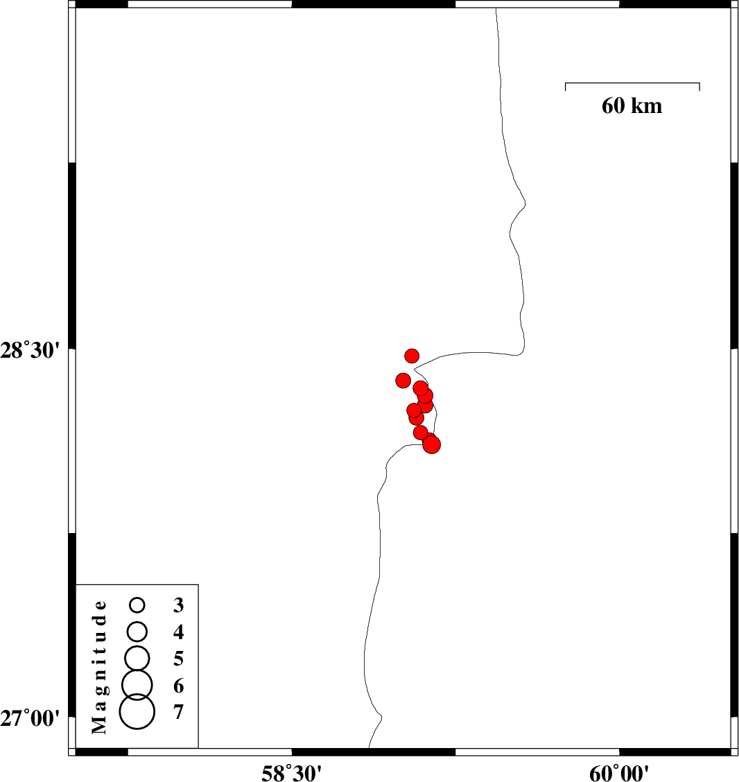
| Prel. Rep. | Date | Time(UTC) | Time(Local) | Lat. | Lon. | Depth | Mag. | Region | Waveform |
|
|
2011/02/08
|
05:47:06.8
|
09:17:06.8
| 28.37 | 59.01 | 16 |
ML:3.1
|
Kerman Province, 104 km South-East of Bam | |
|
|
2011/02/06
|
06:01:07.6
|
09:31:07.6
| 28.47 | 59.05 | 15 |
ML:3
|
Kerman Province, 98 km South-East of Bam | |
|
|
2011/02/05
|
21:55:19.3
|
01:25:19.3
| 28.34 | 59.09 | 14 |
ML:3.1
|
Kerman Province, 112 km South-East of Bam | |
|
|
2011/02/04
|
22:03:23.9
|
01:33:23.9
| 28.25 | 59.06 | 14 |
ML:3
|
Kerman Province, 118 km South-East of Bam | |
|
|
2011/02/04
|
19:19:49.1
|
22:49:49.1
| 28.31 | 59.11 | 14 |
ML:3.2
|
Kerman Province, 115 km South-East of Bam | |
|
|
2011/02/04
|
08:37:08.7
|
12:07:08.7
| 28.11 | 59.14 | 14 |
ML:3.6
|
Sistan va Baloochestan Province, 143 km North-East of Kahnuj | |
|
|
2011/02/04
|
03:12:25.0
|
06:42:25.0
| 28.16 | 59.09 | 14 |
ML:2.9
|
Kerman Province, 139 km North-East of Kahnuj | |
|
|
2011/02/04
|
01:17:23.0
|
04:47:23.0
| 28.13 | 59.13 | 14 |
ML:2.9
|
Kerman Province, 143 km North-East of Kahnuj | |
|
|
2011/02/02
|
06:29:07.7
|
09:59:07.7
| 28.22 | 59.07 | 14 |
ML:3.1
|
Kerman Province, 121 km South-East of Bam | |
|
|
2011/02/01
|
03:01:40.2
|
06:31:40.2
| 28.27 | 59.11 | 14 |
ML:3.2
|
Kerman Province, 119 km South-East of Bam | |
