
Magnitude |
:2.9 |
| Date & Time (UTC) | 2011-02-04 03:12:25.0 |
| Date & Time (Local) | 1389/11/15 06:42:25.0 |
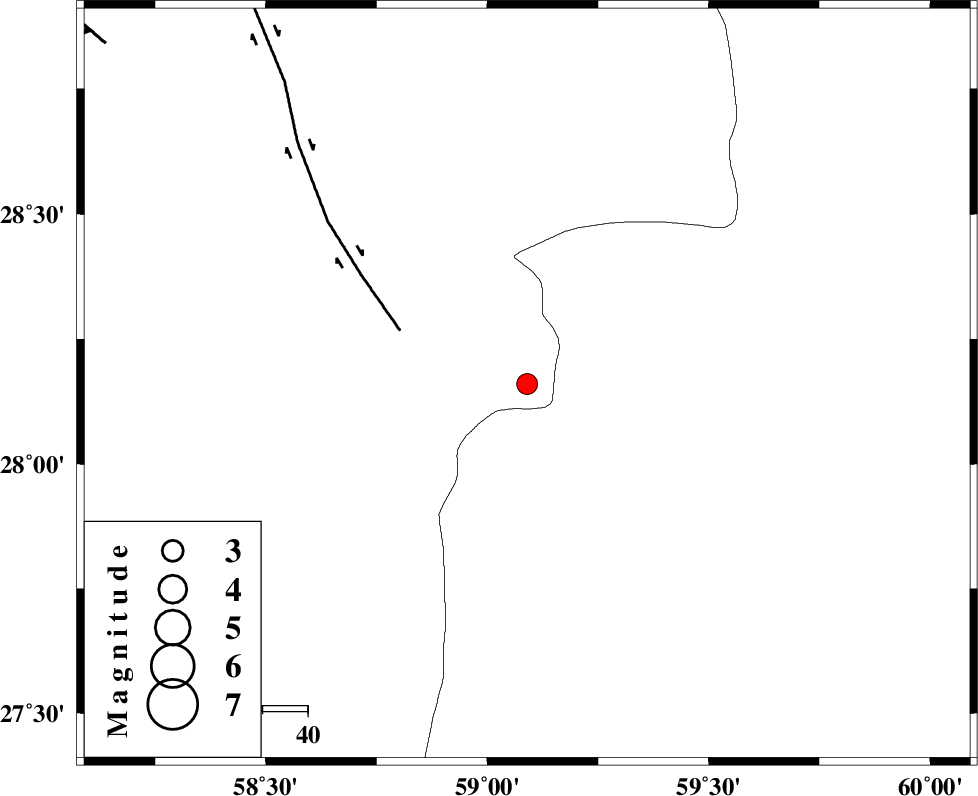
| Location | Lat:28.16 Lon: 59.09 |
| Region | Kerman Province, 139 km North-East of Kahnuj |
Nearest Cities |
|
| 58 km North East of Borj-e abbasabad, Kerman Province | |
| 60 km South of Hoseynabad, Kerman Province | |
| 65 km South East of Mohammadabad-e gonbaki, Kerman Province | |
| 81 km South East of Void, Kerman Province | |
| 85 km North West of Kalemursi, Sistan va Baloochestan Province | |
| Depth | 14 km |
| Agency | |
Faults within 150 km: |
|
| BAM_F (Length: 118 km) , Distance to epicenter: 30 km | |
| KANURAK_F (Length: 135 km) , Distance to epicenter: 102 km | |
| DAMAN_F (Length: 167 km) , Distance to epicenter: 113 km | |
| Number of Phases | 6 |
| RMS | 0.2 |
| Number of Stations | 3 |
| Error in Latitude | >4 km |
| Error in Longitude | 2.7 km |
| Error in Depth | 6.7 km |
Download waveform in seisan format
to download seisan software Click here
to access information about IIEES stations Click here
Amplitude | ||||||||
| UID | Agency | Station | Component | Amplitude | Period | Arrival Time | Proccessing Time | Signal Clip |
| 77782 | IIEES | BNDS | N | 68.2 | 0.48 | 2011-02-04 03:13:53 | 2011-02-04 03:38:00 | n |
| 77783 | IIEES | BNDS | E | 51.4 | 0.68 | 2011-02-04 03:13:57 | 2011-02-04 03:38:00 | n |
| 77784 | IIEES | KRBR | N | 30.8 | 0.52 | 2011-02-04 03:13:54 | 2011-02-04 03:38:00 | n |
| 77785 | IIEES | KRBR | E | 28.9 | 0.52 | 2011-02-04 03:14:05 | 2011-02-04 03:38:00 | n |
Phase | ||||||||||||
| Agency | Station | Component | Phase Type | Phase Quality | First Motion | Observed Arrival Time | Time Residual | Loc. Flag | Input Weight | Distance | Azimuth | |
| IIEES | ZHSF | Z | Pn | E | 2011-02-04 03:13:01 | 0.1 | y | 230 | 45 | |||
| IIEES | ZHSF | N | Sg | E | 2011-02-04 03:13:30 | -0.1 | y | 230 | 45 | |||
| IIEES | BNDS | Z | Pn | E | 2011-02-04 03:13:10 | 0.2 | y | 300 | 254 | |||
| IIEES | BNDS | N | Sg | E | 2011-02-04 03:13:49 | -0.1 | y | 300 | 254 | |||
| IIEES | KRBR | Z | Pn | E | 2011-02-04 03:13:10 | -0.3 | y | 304 | 312 | |||
| IIEES | KRBR | N | Sg | E | 2011-02-04 03:13:50 | 0.2 | y | 304 | 312 | |||