
Magnitude |
:3.2 |
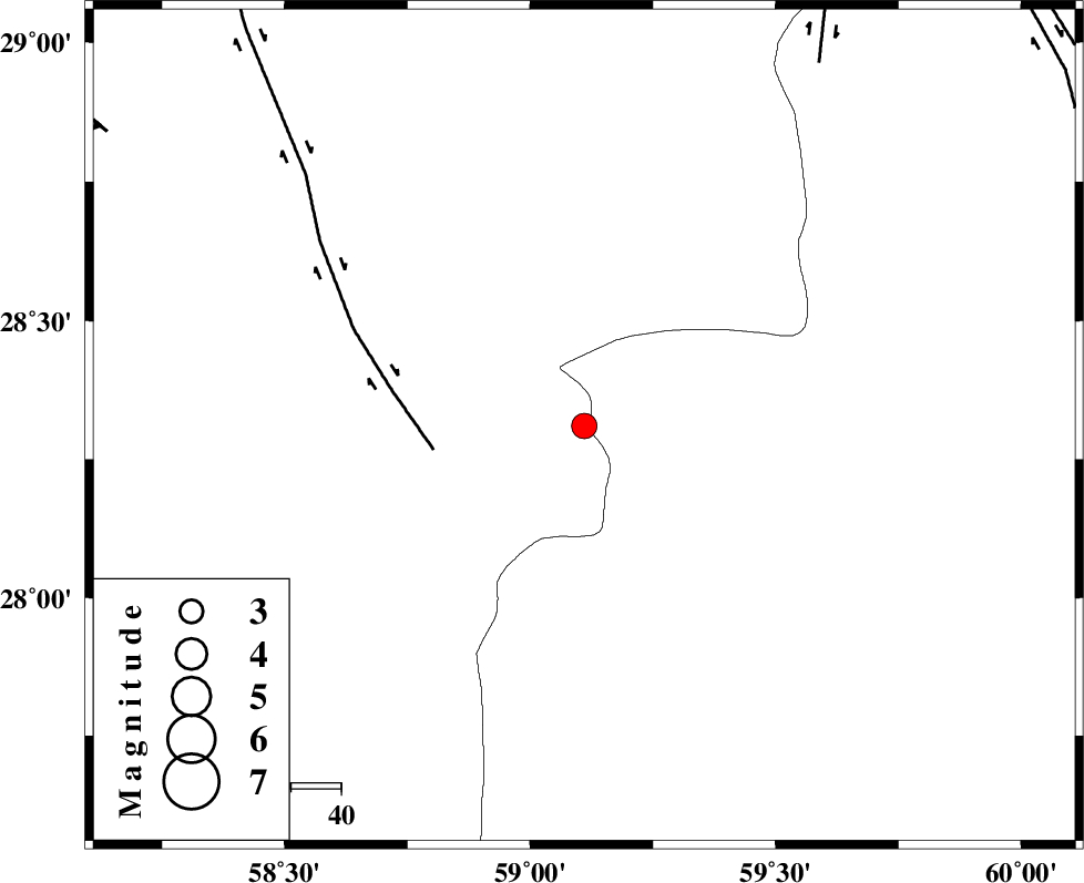
| Date & Time (UTC) | 2011-02-04 19:19:49.1 |
| Date & Time (Local) | 1389/11/15 22:49:49.1 |
| Location | Lat:28.31 Lon: 59.11 |
| Region | Kerman Province, 115 km South-East of Bam |
Nearest Cities |
|
| 44 km South of Hoseynabad, Kerman Province | |
| 51 km South East of Mohammadabad-e gonbaki, Kerman Province | |
| 66 km South East of Void, Kerman Province | |
| 66 km North East of Borj-e abbasabad, Kerman Province | |
| 75 km South East of Fahroj, Kerman Province | |
| Depth | 14 km |
| Agency | |
Faults within 150 km: |
|
| BAM_F (Length: 118 km) , Distance to epicenter: 30 km | |
| KANURAK_F (Length: 135 km) , Distance to epicenter: 86 km | |
| DAMAN_F (Length: 167 km) , Distance to epicenter: 107 km | |
| Number of Phases | 5 |
| RMS | 0 |
| Number of Stations | 3 |
| Error in Latitude | >3.6 km |
| Error in Longitude | 1.2 km |
| Error in Depth | 5.8 km |
Download waveform in seisan format
to download seisan software Click here
to access information about IIEES stations Click here
Amplitude | ||||||||
| UID | Agency | Station | Component | Amplitude | Period | Arrival Time | Proccessing Time | Signal Clip |
| 77792 | IIEES | KRBR | N | 87.2 | 0.4 | 2011-02-04 19:21:19 | 2011-02-04 07:28:00 | n |
| 77793 | IIEES | KRBR | E | 71.7 | 0.48 | 2011-02-04 19:21:22 | 2011-02-04 07:28:00 | n |
| 77794 | IIEES | BNDS | N | 79.8 | 0.4 | 2011-02-04 19:21:15 | 2011-02-04 07:28:00 | n |
| 77795 | IIEES | BNDS | E | 134.2 | 0.4 | 2011-02-04 19:21:16 | 2011-02-04 07:28:00 | n |
Phase | ||||||||||||
| Agency | Station | Component | Phase Type | Phase Quality | First Motion | Observed Arrival Time | Time Residual | Loc. Flag | Input Weight | Distance | Azimuth | |
| IIEES | ZHSF | Z | Pn | E | 2011-02-04 19:20:23 | 0 | y | 218 | 48 | |||
| IIEES | ZHSF | E | Sg | E | 2011-02-04 19:20:50 | 0 | y | 218 | 48 | |||
| IIEES | KRBR | Z | Pn | E | 2011-02-04 19:20:33 | 0.1 | y | 294 | 310 | |||
| IIEES | KRBR | N | Sg | E | 2011-02-04 19:21:12 | 0 | y | 294 | 310 | |||
| IIEES | BNDS | Z | Pn | E | 2011-02-04 19:20:34 | 0 | y | 306 | 252 | |||