
Magnitude |
:3.2 |
| Date & Time (UTC) | 2011-02-01 03:01:40.2 |
| Date & Time (Local) | 1389/11/12 06:31:40.2 |
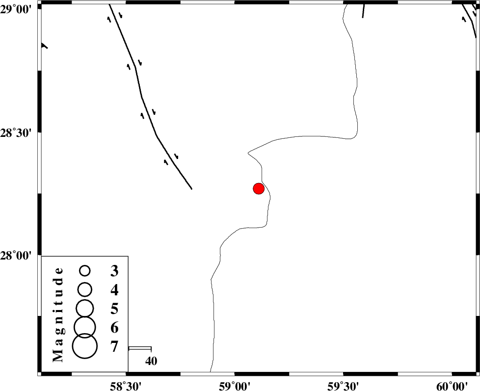
| Location | Lat:28.27 Lon: 59.11 |
| Region | Kerman Province, 119 km South-East of Bam |
Nearest Cities |
|
| 48 km South of Hoseynabad, Kerman Province | |
| 55 km South East of Mohammadabad-e gonbaki, Kerman Province | |
| 64 km North East of Borj-e abbasabad, Kerman Province | |
| 70 km South East of Void, Kerman Province | |
| 79 km South East of Fahroj, Kerman Province | |
| Depth | 14 km |
| Agency | |
Faults within 150 km: |
|
| BAM_F (Length: 118 km) , Distance to epicenter: 30 km | |
| KANURAK_F (Length: 135 km) , Distance to epicenter: 90 km | |
| DAMAN_F (Length: 167 km) , Distance to epicenter: 108 km | |
| Number of Phases | 5 |
| RMS | 0.2 |
| Number of Stations | 3 |
| Error in Latitude | >6.6 km |
| Error in Longitude | 2.2 km |
| Error in Depth | 10.6 km |
Download waveform in seisan format
to download seisan software Click here
to access information about IIEES stations Click here
Amplitude | ||||||||
| UID | Agency | Station | Component | Amplitude | Period | Arrival Time | Proccessing Time | Signal Clip |
| 77766 | IIEES | KRBR | N | 107 | 0.72 | 2011-02-01 03:03:10 | 2011-02-01 03:12:00 | n |
| 77767 | IIEES | KRBR | E | 77.7 | 0.48 | 2011-02-01 03:03:11 | 2011-02-01 03:12:00 | n |
| 77768 | IIEES | BNDS | E | 105 | 0.44 | 2011-02-01 03:03:04 | 2011-02-01 03:12:00 | n |
| 77769 | IIEES | BNDS | N | 86.3 | 0.52 | 2011-02-01 03:03:13 | 2011-02-01 03:12:00 | n |
Phase | ||||||||||||
| Agency | Station | Component | Phase Type | Phase Quality | First Motion | Observed Arrival Time | Time Residual | Loc. Flag | Input Weight | Distance | Azimuth | |
| IIEES | ZHSF | Z | Pn | E | 2011-02-01 03:02:15 | 0.3 | y | 220 | 47 | |||
| IIEES | ZHSF | E | Sg | E | 2011-02-01 03:02:42 | -0.1 | y | 220 | 47 | |||
| IIEES | KRBR | Z | Pn | E | 2011-02-01 03:02:24 | -0.1 | y | 297 | 310 | |||
| IIEES | KRBR | E | Sg | E | 2011-02-01 03:03:04 | 0.1 | y | 297 | 310 | |||
| IIEES | BNDS | Z | Pn | E | 2011-02-01 03:02:25 | -0.1 | y | 305 | 252 | |||