
Magnitude |
:2.9 |
| Date & Time (UTC) | 2011-02-04 01:17:23.0 |
| Date & Time (Local) | 1389/11/15 04:47:23.0 |
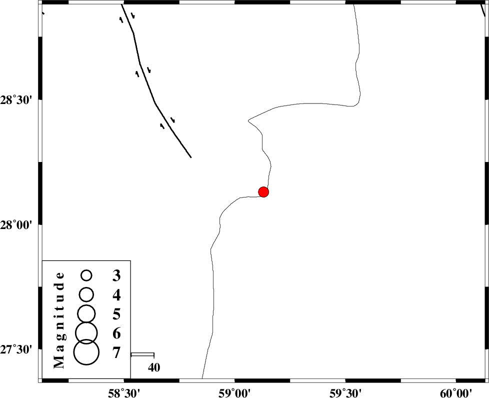
| Location | Lat:28.13 Lon: 59.13 |
| Region | Kerman Province, 143 km North-East of Kahnuj |
Nearest Cities |
|
| 61 km North East of Borj-e abbasabad, Kerman Province | |
| 64 km South of Hoseynabad, Kerman Province | |
| 70 km South East of Mohammadabad-e gonbaki, Kerman Province | |
| 81 km North West of Kalemursi, Sistan va Baloochestan Province | |
| 85 km South East of Void, Kerman Province | |
| Depth | 14 km |
| Agency | |
Faults within 150 km: |
|
| BAM_F (Length: 118 km) , Distance to epicenter: 35 km | |
| KANURAK_F (Length: 135 km) , Distance to epicenter: 103 km | |
| KASKIN_F (Length: 100 km) , Distance to epicenter: 110 km | |
| Number of Phases | 5 |
| RMS | 0.1 |
| Number of Stations | 3 |
| Error in Latitude | >4.1 km |
| Error in Longitude | 1.4 km |
| Error in Depth | 6.6 km |
Download waveform in seisan format
to download seisan software Click here
to access information about IIEES stations Click here
Amplitude | ||||||||
| UID | Agency | Station | Component | Amplitude | Period | Arrival Time | Proccessing Time | Signal Clip |
| 77778 | IIEES | BNDS | E | 46.7 | 0.44 | 2011-02-04 01:18:48 | 2011-02-04 01:57:00 | n |
| 77779 | IIEES | BNDS | N | 60.7 | 0.48 | 2011-02-04 01:18:52 | 2011-02-04 01:57:00 | n |
| 77780 | IIEES | KRBR | E | 31.2 | 0.36 | 2011-02-04 01:18:55 | 2011-02-04 01:57:00 | n |
| 77781 | IIEES | KRBR | N | 33.8 | 0.44 | 2011-02-04 01:18:56 | 2011-02-04 01:57:00 | n |
Phase | ||||||||||||
| Agency | Station | Component | Phase Type | Phase Quality | First Motion | Observed Arrival Time | Time Residual | Loc. Flag | Input Weight | Distance | Azimuth | |
| IIEES | ZHSF | Z | Pn | E | 2011-02-04 01:17:59 | 0 | y | 229 | 44 | |||
| IIEES | ZHSF | E | Sg | E | 2011-02-04 01:18:28 | 0 | y | 229 | 44 | |||
| IIEES | BNDS | Z | Pn | E | 2011-02-04 01:18:08 | 0 | y | 303 | 255 | |||
| IIEES | KRBR | Z | Pn | E | 2011-02-04 01:18:09 | 0.1 | y | 309 | 312 | |||
| IIEES | KRBR | E | Sg | E | 2011-02-04 01:18:50 | 0 | y | 309 | 312 | |||