
| Prel. Rep. | Date | Time(UTC) | Time(Local) | Lat. | Lon. | Depth | Mag. | Region | Waveform |
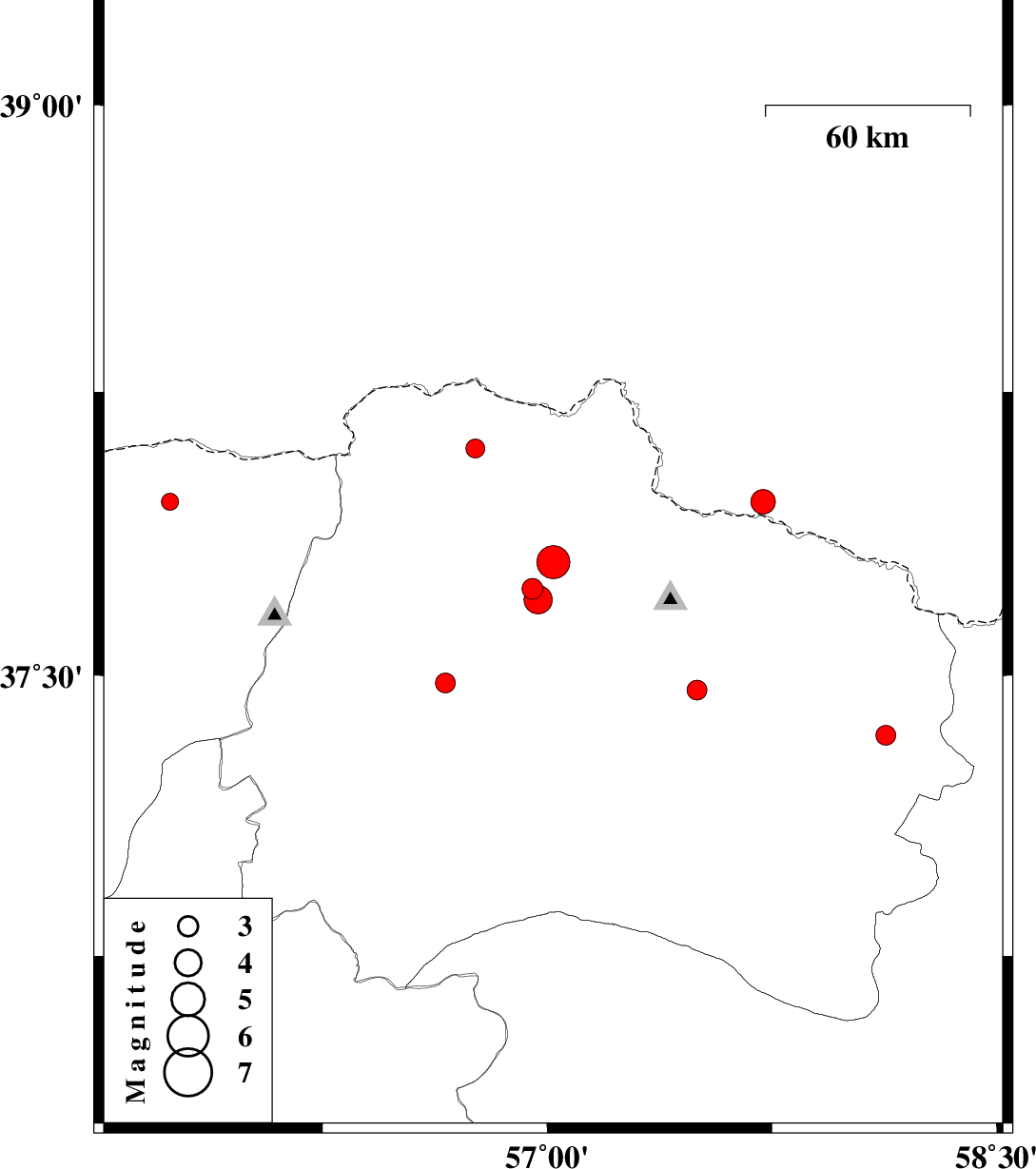
| 2010/08/11 | 17:26:19.7 | 21:56:19.7 | 37.8 | 57.02 | 15 | ML:5 | Khorasan(north) Province, 29 km North of Ashkhaneh | ||
| 2010/08/11 | 06:45:19.2 | 11:15:19.2 | 37.48 | 56.66 | 15 | ML:2.9 | Khorasan(north) Province, 26 km West of Ashkhaneh | ||
| 2010/08/09 | 11:57:32.5 | 16:27:32.5 | 37.34 | 58.13 | 35 | ML:3 | Khorasan(north) Province, 19 km East of Shirvan | ||
| 2010/08/08 | 09:39:02.1 | 14:09:02.1 | 37.96 | 57.72 | 14 | ML:3.7 | 58 km West of Ashgabat | ||
| 2010/07/28 | 22:10:51.8 | 02:40:51.8 | 37.96 | 55.74 | 12 | ML:2.6 | Golestan Province, 68 km North-East of Kalaleh | ||
| 2010/07/23 | 01:01:14.3 | 05:31:14.3 | 37.73 | 56.95 | 14 | ML:3.1 | Khorasan(north) Province, 20 km North of Ashkhaneh | ||
| 2010/07/23 | 00:56:40.9 | 05:26:40.9 | 37.7 | 56.97 | 9 | ML:4.2 | Khorasan(north) Province, 17 km North of Ashkhaneh | ||
| 2010/07/20 | 15:54:12.4 | 20:24:12.4 | 38.1 | 56.76 | 14 | ML:2.8 | Khorasan(north) Province, 64 km North-West of Ashkhaneh | ||
| 2010/07/14 | 03:40:02.2 | 08:10:02.2 | 37.46 | 57.5 | 18 | ML:2.9 | Khorasan(north) Province, 15 km East of Bojnurd |