
| Prel. Rep. | Date | Time(UTC) | Time(Local) | Lat. | Lon. | Depth | Mag. | Region | Waveform |
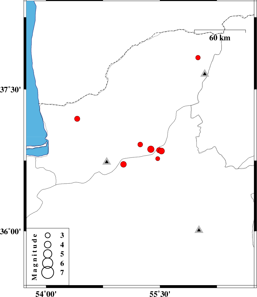
| 2009/10/29 | 21:30:00.9 | 01:00:00.9 | 36.92 | 55.24 | 14 | ML:2.9 | Golestan Province, 14 km Ramian | ||
| 2009/10/29 | 11:32:10.9 | 15:02:10.9 | 37.19 | 54.41 | 18 | ML:3.3 | Golestan Province, 20 km North of Aq Qaleh | ||
| 2009/10/20 | 21:48:31.8 | 01:18:31.8 | 36.71 | 55.02 | 7 | ML:3.5 | Semnan Province, 25 km South-East of Ali Abad | ||
| 2009/10/19 | 22:04:45.0 | 01:34:45.0 | 36.77 | 55.47 | 14 | ML:2.6 | Semnan Province, 52 km South of Minodasht | ||
| 2009/10/06 | 14:43:01.2 | 18:13:01.2 | 36.85 | 55.52 | 7 | ML:3.7 | Semnan Province, 44 km South-East of Minodasht | ||
| 2009/09/29 | 15:28:50.9 | 18:58:50.9 | 37.83 | 56 | 15 | ML:2.8 | Golestan Province, 67 km North-East of Kalaleh | ||
| 2009/09/29 | 06:52:34.1 | 10:22:34.1 | 36.86 | 55.49 | 6 | ML:3.3 | Semnan Province, 42 km South-East of Minodasht | ||
| 2009/09/29 | 06:32:04.5 | 10:02:04.5 | 36.87 | 55.38 | 14 | ML:4 | Golestan Province, 40 km South of Minodasht |