
Magnitude |
:3.3 |
| Date & Time (UTC) | 2009-09-29 06:52:34.1 |
| Date & Time (Local) | 1388/7/7 10:22:34.1 |
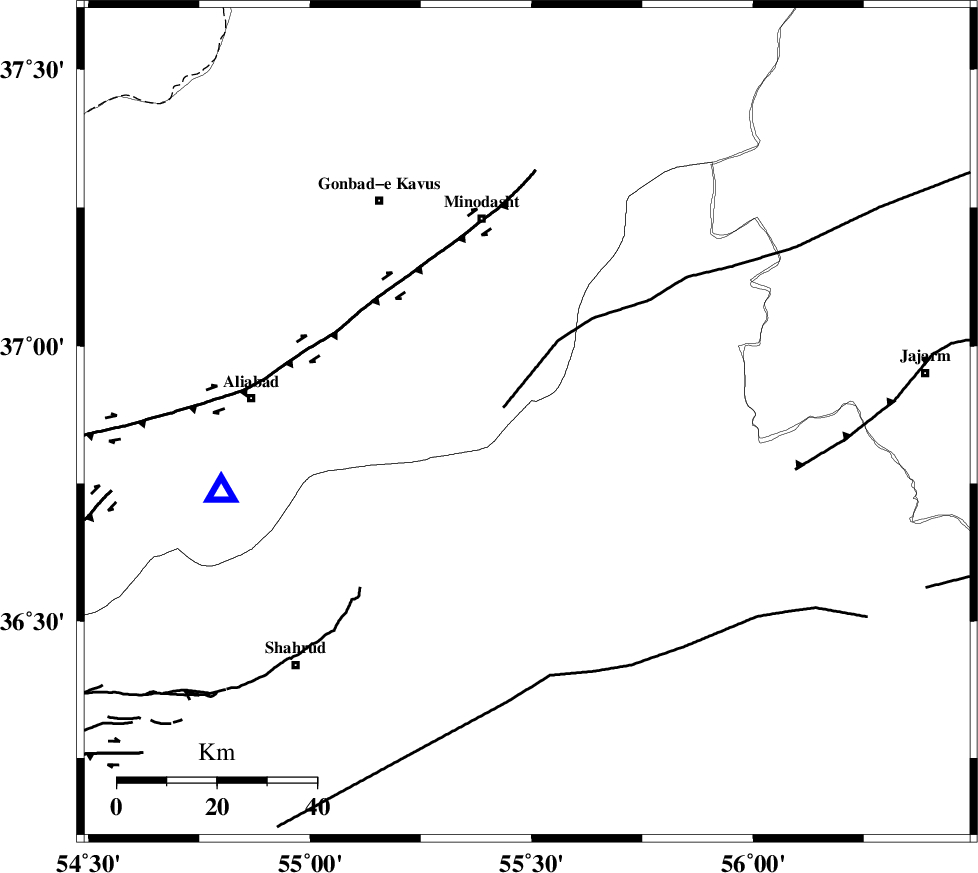
| Location | Lat:36.86 Lon: 55.49 |
| Region | Semnan Province, 42 km South-East of Minodasht |
Nearest Cities |
|
| 12 km of Farsian, Golestan Province | |
| 19 km South West of Qaleh qafeh, Semnan Province | |
| 20 km South of Qale-ye qafeh, Golestan Province | |
| 27 km North East of Kalateh khanj, Semnan Province | |
| 30 km South of Duzin, Golestan Province | |
| Depth | 6 km |
| Agency | |
Faults within 150 km: |
|
| ROBATE_QARABIL_F (Length: 168 km) , Distance to epicenter: 6 km | |
| SHAVAR_F (Length: 87 km) , Distance to epicenter: 27 km | |
| KHAZAR_F (Length: 523 km) , Distance to epicenter: 49 km | |
| Number of Phases | 4 |
| RMS | 0 |
| Number of Stations | 4 |
| Error in Latitude | >1.6 km |
| Error in Longitude | 4.8 km |
| Error in Depth | 4 km |
Download waveform in seisan format
to download seisan software Click here
to access information about IIEES stations Click here
Amplitude | ||||||||
| UID | Agency | Station | Component | Amplitude | Period | Arrival Time | Proccessing Time | Signal Clip |
| 58709 | IIEES | MRVT | N | 855.6 | 0.41 | 2009-09-29 06:53:10 | 2009-10-25 09:10:00 | n |
| 58710 | IIEES | MRVT | E | 1002.3 | 0.64 | 2009-09-29 06:53:12 | 2009-10-25 09:10:00 | n |
| 58711 | IIEES | SHRT | N | 19.9 | 0.69 | 2009-09-29 06:55:21 | 2009-10-25 09:10:00 | n |
Phase | ||||||||||||
| Agency | Station | Component | Phase Type | Phase Quality | First Motion | Observed Arrival Time | Time Residual | Loc. Flag | Input Weight | Distance | Azimuth | |
| IIEES | MRVT | Z | Pg | E | 2009-09-29 06:52:52 | 0 | y | 103 | 31 | |||
| IIEES | SHRO | Z | Pg | E | 2009-09-29 06:52:52 | 0 | y | 105 | 154 | |||
| IIEES | NASN | Z | Pn | E | 2009-09-29 06:53:46 | 0 | y | 513 | 209 | |||
| IIEES | SHRT | Z | Pn | E | 2009-09-29 06:53:52 | 0 | y | 563 | 128 | |||