| Prel. Rep. | Date | Time(UTC) | Time(Local) | Lat. | Lon. | Depth | Mag. | Region | Waveform |
|
|
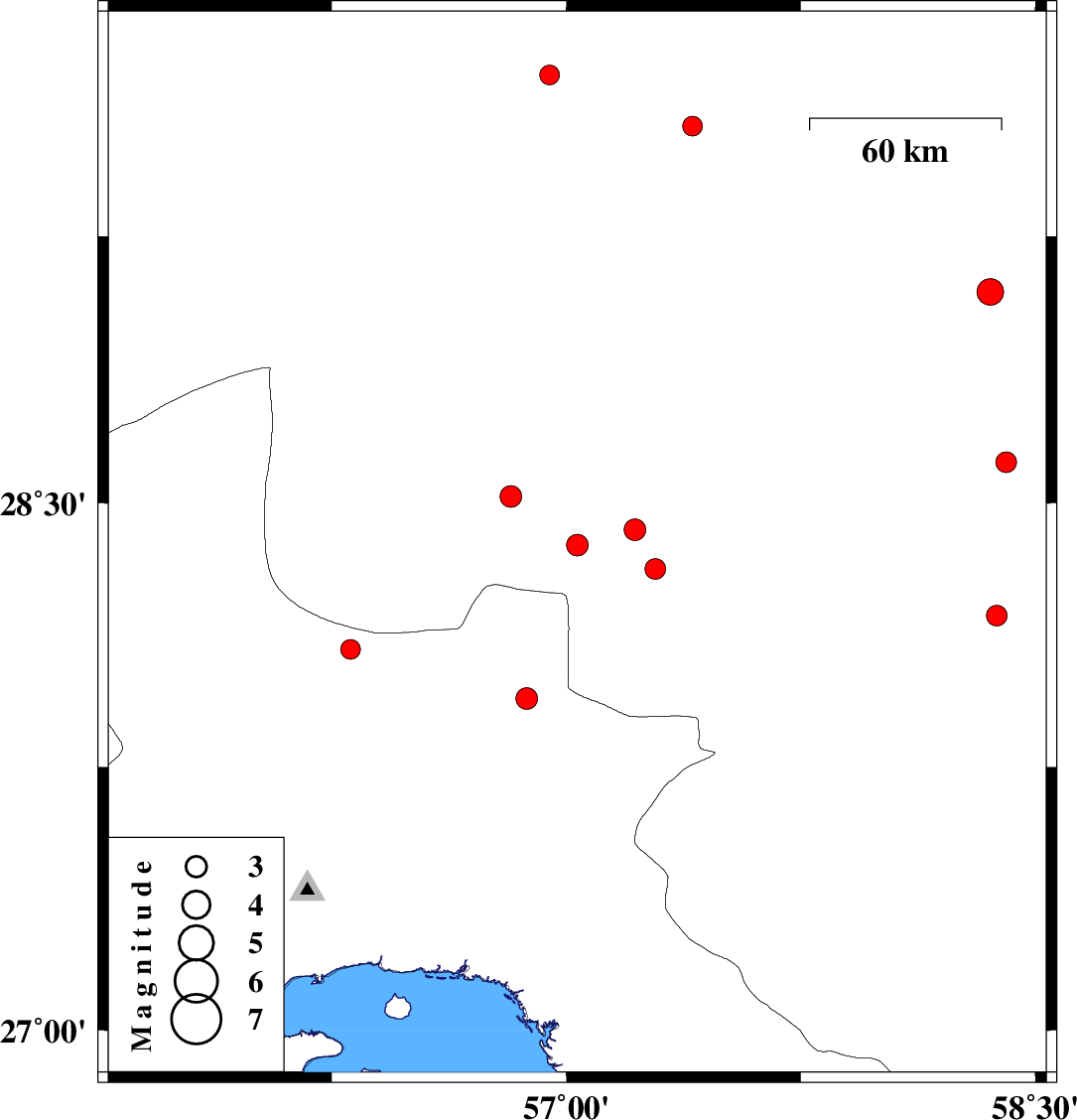
2015/08/11
|
02:59:49.6
|
07:29:49.6
| 28.38 | 57.035 | 16 |
ML:3.1
|
Kerman Province, 76 km South-West of Jiroft | |
|
|
2015/08/05
|
10:39:24.3
|
15:09:24.3
| 27.149 | 55.968 | 14 |
ML:2.8
|
Hormozgan Province, 31 km -West of Bandar-e abbas | |
|
|
2015/08/01
|
10:47:44.9
|
15:17:44.9
| 29.701 | 56.946 | 18 |
ML:2.8
|
Kerman Province, 44 km South-East of Bardsir | |
|
|
2015/07/29
|
11:00:12.5
|
15:30:12.5
| 29.094 | 58.356 | 18 |
ML:3.8
|
Kerman Province, 2 km of Bam | |
|
|
2015/07/29
|
05:11:59.0
|
09:41:59.0
| 28.313 | 57.285 | 6 |
ML:2.9
|
Kerman Province, 57 km North-West of Kahnuj | |
|
|
2015/07/26
|
22:40:34.6
|
03:10:34.6
| 28.181 | 58.377 | 14 |
ML:3
|
Kerman Province, 72 km North-East of Kahnuj | |
|
|
2015/07/21
|
09:29:11.7
|
13:59:11.7
| 27.946 | 56.873 | 14 |
ML:3.1
|
Hormozgan Province, 81 km -West of Kahnuj | |
|
|
2015/07/20
|
14:54:15.1
|
19:24:15.1
| 28.614 | 58.406 | 18 |
ML:2.9
|
Kerman Province, 55 km South of Bam | |
|
|
2015/07/19
|
00:55:03.4
|
05:25:03.4
| 28.518 | 56.823 | 15 |
ML:3.1
|
Kerman Province, 82 km South-East of Baft | |
|
|
2015/07/18
|
05:42:57.5
|
10:12:57.5
| 28.423 | 57.219 | 14 |
ML:3.1
|
Kerman Province, 58 km South-West of Jiroft | |
|
|
2015/07/17
|
19:55:01.3
|
00:25:01.3
| 29.558 | 57.404 | 18 |
ML:2.8
|
Kerman Province, 87 km South-East of Kerman | |
|
|
2015/07/17
|
15:40:39.4
|
20:10:39.4
| 28.085 | 56.31 | 15 |
ML:2.8
|
Hormozgan Province, 47 km South-East of Hajiabad | |
