
Magnitude |
:2.8 |
| Date & Time (UTC) | 2015-08-01 10:47:44.9 |
| Date & Time (Local) | 1394/5/10 15:17:44.9 |
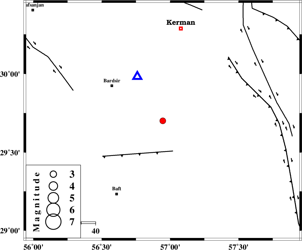
| Location | Lat:29.701 Lon: 56.946 |
| Region | Kerman Province, 44 km South-East of Bardsir |
Nearest Cities |
|
| 23 km South East of Negar, Kerman Province | |
| 24 km North East of Lalehzar, Kerman Province | |
| 33 km North East of Ghale-ye asgar, Kerman Province | |
| 35 km South East of Dashtkar, Kerman Province | |
| 40 km North of Siyah bonueyeh, Kerman Province | |
| Depth | 18 km |
| Agency | |
Faults within 150 km: |
|
| LALEHZAR_F (Length: 52 km) , Distance to epicenter: 23 km | |
| GOWK_F (Length: 152 km) , Distance to epicenter: 63 km | |
| RAFSANJAN_F (Length: 129 km) , Distance to epicenter: 67 km | |
| Number of Phases | 4 |
| RMS | 0.1 |
| Number of Stations | 3 |
| Error in Latitude | >4.6 km |
| Error in Longitude | 3.9 km |
| Error in Depth | 6.1 km |
Download waveform in seisan format
to download seisan software Click here
to access information about IIEES stations Click here
Amplitude | ||||||||
| UID | Agency | Station | Component | Amplitude | Period | Arrival Time | Proccessing Time | Signal Clip |
| 100229 | IIEES | KRBR | N | 878.3 | 0.05 | 2015-08-01 10:48:04 | 2015-08-02 07:17:00 | n |
| 100230 | IIEES | KRBR | E | 1294.6 | 0.14 | 2015-08-01 10:48:04 | 2015-08-02 07:17:00 | n |
Phase | ||||||||||||
| Agency | Station | Component | Phase Type | Phase Quality | First Motion | Observed Arrival Time | Time Residual | Loc. Flag | Input Weight | Distance | Azimuth | |
| IIEES | KRBR | Z | Pg | E | 2015-08-01 10:47:52 | 0.03 | y | 35.9 | 330 | |||
| IIEES | BSRN | Z | Pn | E | 2015-08-01 10:48:32 | -0.12 | y | 326 | 39 | |||
| IIEES | BSRN | N | Sg | E | 2015-08-01 10:49:16 | 0.03 | y | 326 | 39 | |||
| IIEES | ZHSF | Z | Pn | E | 2015-08-01 10:48:38 | 0.06 | y | 371 | 91 | |||