
Magnitude |
:3.1 |
| Date & Time (UTC) | 2015-08-11 02:59:49.6 |
| Date & Time (Local) | 1394/5/20 07:29:49.6 |
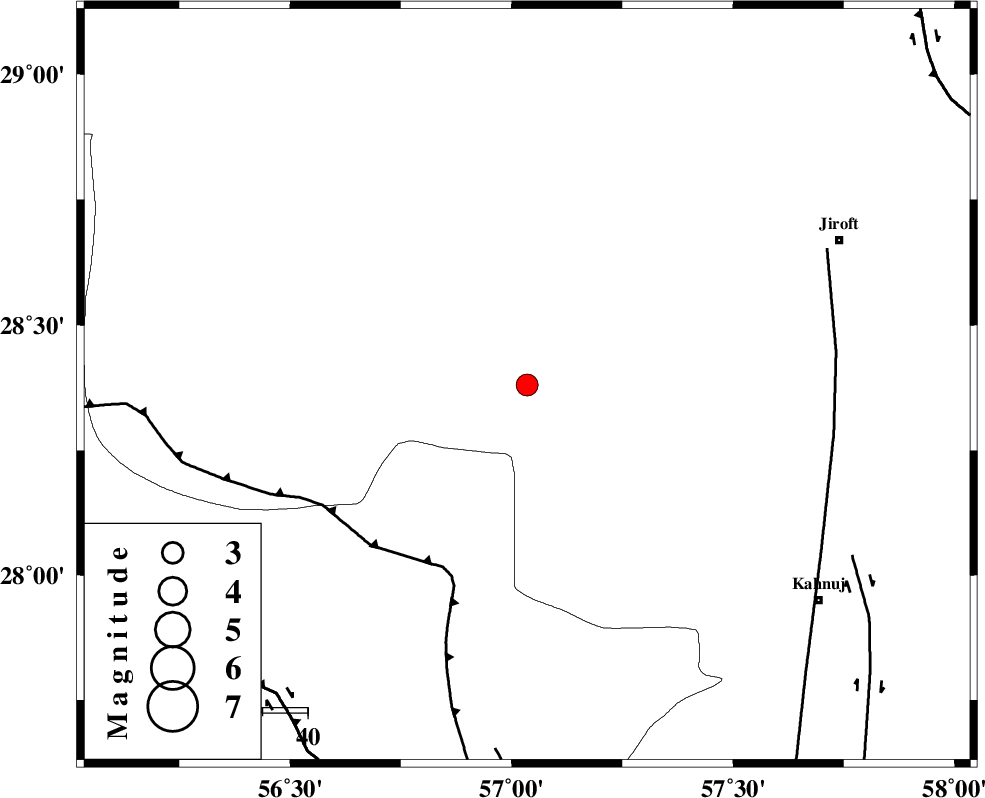
| Location | Lat:28.38 Lon: 57.035 |
| Region | Kerman Province, 76 km South-West of Jiroft |
Nearest Cities |
|
| 16 km North East of Sarkhan, Kerman Province | |
| 34 km North West of Hurpasefid, Kerman Province | |
| 38 km South of Dolatabad, Kerman Province | |
| 42 km North West of Faryab, Kerman Province | |
| 49 km North West of Mehrueye-e paeen, Kerman Province | |
| Depth | 16 km |
| Agency | |
Faults within 150 km: |
|
| MAIN_ZAGROS_R_F (Length: 1106 km) , Distance to epicenter: 45 km | |
| SABZEVARAN_F (Length: 190 km) , Distance to epicenter: 69 km | |
| ZENDAN_MINAB_F_Z1 (Length: 183 km) , Distance to epicenter: 81 km | |
| Number of Phases | 6 |
| RMS | 0.2 |
| Number of Stations | 5 |
| Error in Latitude | >3.2 km |
| Error in Longitude | 8.2 km |
| Error in Depth | 6.3 km |
Download waveform in seisan format
to download seisan software Click here
to access information about IIEES stations Click here
Amplitude | ||||||||
| UID | Agency | Station | Component | Amplitude | Period | Arrival Time | Proccessing Time | Signal Clip |
| 100302 | IIEES | KRBR | E | 198.7 | 0.35 | 2015-08-11 03:00:48 | 2015-08-12 08:24:00 | n |
Phase | ||||||||||||
| Agency | Station | Component | Phase Type | Phase Quality | First Motion | Observed Arrival Time | Time Residual | Loc. Flag | Input Weight | Distance | Azimuth | |
| IIEES | BNDS | Z | Pg | E | 2015-08-11 03:00:12 | 0.29 | y | 138 | 218 | |||
| IIEES | BNDS | N | Sg | E | 2015-08-11 03:00:29 | -0.21 | y | 138 | 218 | |||
| IIEES | KRBR | Z | Pg | E | 2015-08-11 03:00:19 | -0.07 | y | 180 | 352 | |||
| IIEES | BSRN | Z | Pn | E | 2015-08-11 03:00:52 | -0.19 | y | 446 | 26 | |||
| IIEES | YZKH | Z | Pn | E | 2015-08-11 03:00:59 | 0.06 | y | 503 | 333 | |||
| IIEES | TABS | Z | Pn | E | 2015-08-11 03:01:09 | 0.17 | y | 584 | 1 | |||