
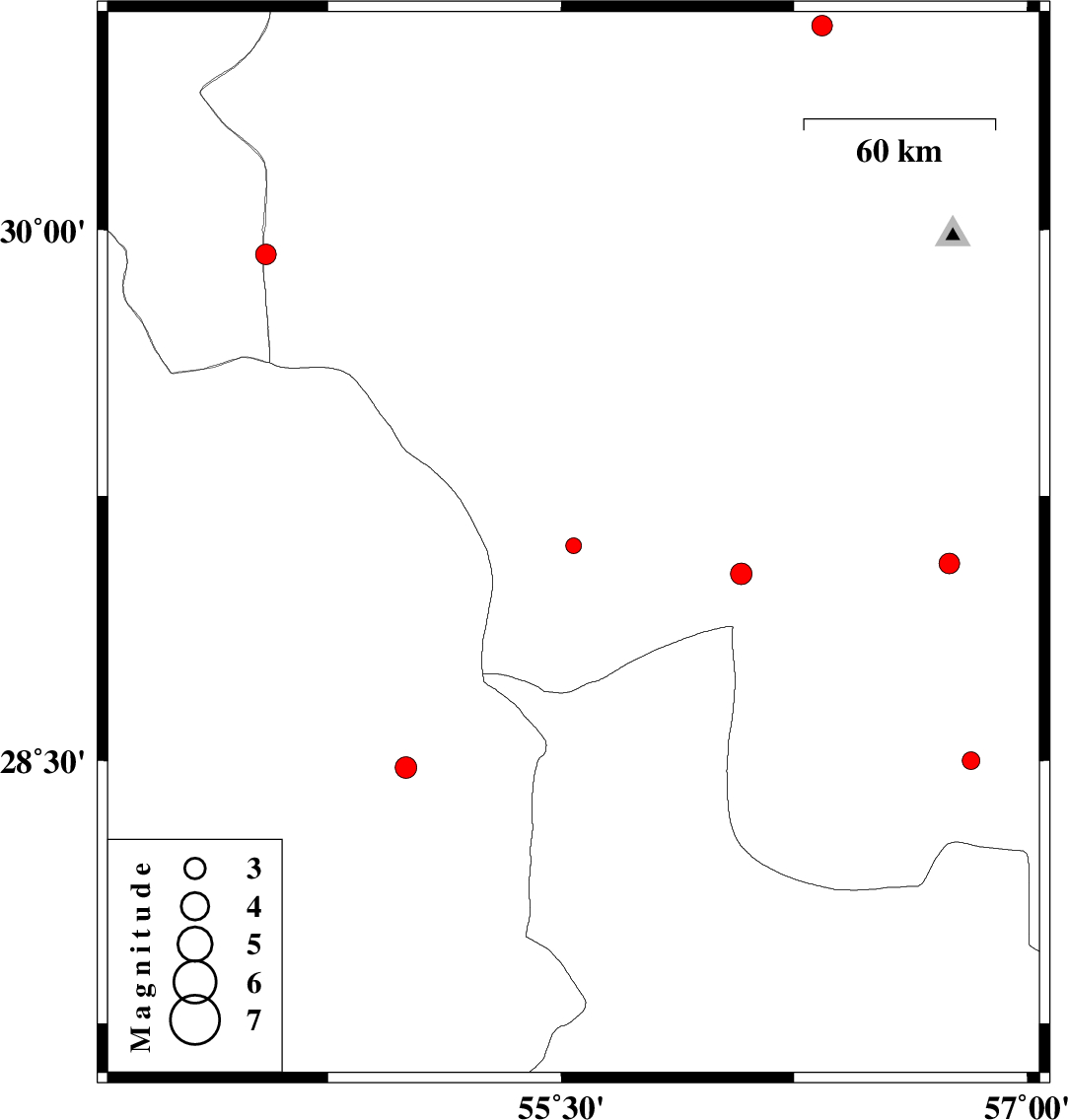
| Prel. Rep. | Date | Time(UTC) | Time(Local) | Lat. | Lon. | Depth | Mag. | Region | Waveform |
| 2015/05/31 | 08:40:50.5 | 13:10:50.5 | 29.11 | 55.54 | 14 | ML:2.2 | Kerman Province, 40 km South-West of Sirjan | ||
| 2015/05/30 | 14:22:12.0 | 18:52:12.0 | 28.48 | 55 | 17 | ML:3.1 | Fars Province, 54 km South-East of Darab | ||
| 2015/05/27 | 19:16:55.3 | 23:46:55.3 | 29.03 | 56.08 | 16 | ML:3.1 | Kerman Province, 56 km South-West of Baft | ||
| 2015/05/21 | 02:12:04.1 | 06:42:04.1 | 28.5 | 56.82 | 17 | ML:2.6 | Kerman Province, 84 km South-East of Baft | ||
| 2015/05/16 | 20:39:35.4 | 01:09:35.4 | 29.06 | 56.75 | 16 | ML:3 | Kerman Province, 24 km South-East of Baft | ||
| 2015/05/15 | 19:08:56.6 | 23:38:56.6 | 30.57 | 56.34 | 16 | ML:2.9 | Kerman Province, 34 km South-West of Zarand | ||
| 2015/05/14 | 11:33:17.1 | 16:03:17.1 | 29.93 | 54.55 | 14 | ML:3 | Kerman Province, 23 km South-East of Harat |