
Magnitude |
:3 |
| Date & Time (UTC) | 2015-05-16 20:39:35.4 |
| Date & Time (Local) | 1394/2/27 01:09:35.4 |
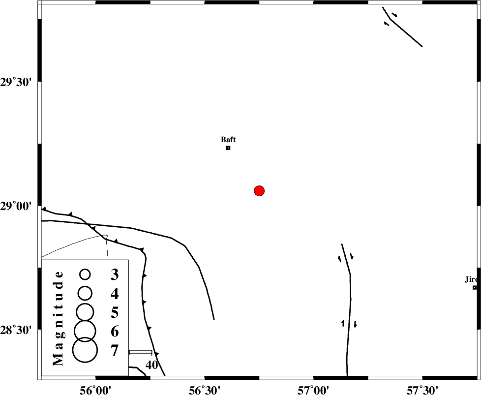
| Location | Lat:29.06 Lon: 56.75 |
| Region | Kerman Province, 24 km South-East of Baft |
Nearest Cities |
|
| 17 km North East of Kashkueyeh, Kerman Province | |
| 23 km South of Bezanjan, Kerman Province | |
| 24 km South East of Baft, Kerman Province | |
| 29 km South of Askar, Kerman Province | |
| 30 km South West of Rabar, Kerman Province | |
| Depth | 16 km |
| Agency | |
Faults within 150 km: |
|
| LALEHZAR_F (Length: 52 km) , Distance to epicenter: 52 km | |
| MAIN_ZAGROS_R_F (Length: 1106 km) , Distance to epicenter: 100 km | |
| RAFSANJAN_F (Length: 129 km) , Distance to epicenter: 103 km | |
| Number of Phases | 5 |
| RMS | 0.1 |
| Number of Stations | 3 |
| Error in Latitude | >1.8 km |
| Error in Longitude | 8.5 km |
| Error in Depth | 4.9 km |
Download waveform in seisan format
to download seisan software Click here
to access information about IIEES stations Click here
Amplitude | ||||||||
| UID | Agency | Station | Component | Amplitude | Period | Arrival Time | Proccessing Time | Signal Clip |
| 95705 | IIEES | KRBR | E | 1161.7 | 0.16 | 2015-05-16 20:40:06 | 2015-05-16 10:09:00 | n |
| 95706 | IIEES | KRBR | N | 623.7 | 0.16 | 2015-05-16 20:40:06 | 2015-05-16 10:09:00 | n |
| 95707 | IIEES | BNDS | E | 92.3 | 0.36 | 2015-05-16 20:40:33 | 2015-05-16 10:09:00 | n |
| 95708 | IIEES | BSRN | N | 13 | 0.72 | 2015-05-16 20:41:33 | 2015-05-16 10:09:00 | n |
Phase | ||||||||||||
| Agency | Station | Component | Phase Type | Phase Quality | First Motion | Observed Arrival Time | Time Residual | Loc. Flag | Input Weight | Distance | Azimuth | |
| IIEES | KRBR | Z | Pg | E | 2015-05-16 20:39:53 | 0.1 | y | 103 | 0 | |||
| IIEES | KRBR | N | Sg | E | 2015-05-16 20:40:05 | -0.07 | y | 103 | 0 | |||
| IIEES | BNDS | Z | Pn | E | 2015-05-16 20:40:06 | 0.02 | y | 192 | 197 | |||
| IIEES | BNDS | N | Sg | E | 2015-05-16 20:40:30 | -0.03 | y | 192 | 197 | |||
| IIEES | BSRN | Z | Pn | E | 2015-05-16 20:40:32 | -0.03 | y | 395 | 35 | |||