
Magnitude |
:3 |
| Date & Time (UTC) | 2015-05-14 11:33:17.1 |
| Date & Time (Local) | 1394/2/24 16:03:17.1 |
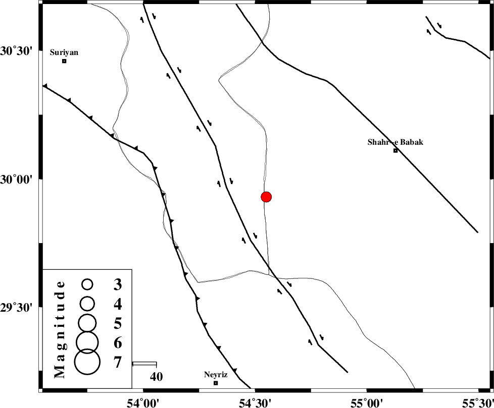
| Location | Lat:29.93 Lon: 54.55 |
| Region | Kerman Province, 23 km South-East of Harat |
Nearest Cities |
|
| 23 km South East of Harat, Yazd Province | |
| 24 km South East of Fathabad, Yazd Province | |
| 26 km North East of Chahak, Yazd Province | |
| 41 km East of Khvansar, Yazd Province | |
| 54 km North East of Moshkan, Fars Province | |
| Depth | 14 km |
| Agency | |
Faults within 150 km: |
|
| SHAHR_E_BABAK_F1 (Length: 392 km) , Distance to epicenter: 18 km | |
| MAIN_ZAGROS_R_F (Length: 1106 km) , Distance to epicenter: 43 km | |
| SHAHR_E_BABAK_F2 (Length: 272 km) , Distance to epicenter: 55 km | |
| Number of Phases | 5 |
| RMS | 0.1 |
| Number of Stations | 3 |
| Error in Latitude | >4.2 km |
| Error in Longitude | 5.3 km |
| Error in Depth | 6.1 km |
Download waveform in seisan format
to download seisan software Click here
to access information about IIEES stations Click here
Amplitude | ||||||||
| UID | Agency | Station | Component | Amplitude | Period | Arrival Time | Proccessing Time | Signal Clip |
| 95672 | IIEES | KRBR | N | 118.1 | 0.44 | 2015-05-14 11:34:29 | 2015-05-14 01:03:00 | n |
Phase | ||||||||||||
| Agency | Station | Component | Phase Type | Phase Quality | First Motion | Observed Arrival Time | Time Residual | Loc. Flag | Input Weight | Distance | Azimuth | |
| IIEES | KRBR | Z | Pg | E | 2015-05-14 11:33:52 | -0.17 | y | 213 | 88 | |||
| IIEES | KRBR | N | Sg | E | 2015-05-14 11:34:17 | 0.05 | y | 213 | 88 | |||
| IIEES | YZKH | Z | Pn | E | 2015-05-14 11:33:58 | 0.03 | y | 273 | 1 | |||
| IIEES | YZKH | E | Sg | E | 2015-05-14 11:34:34 | -0.04 | y | 273 | 1 | |||
| IIEES | BSRN | Z | Pn | E | 2015-05-14 11:34:26 | 0.21 | y | 492 | 62 | |||