| Prel. Rep. | Date | Time(UTC) | Time(Local) | Lat. | Lon. | Depth | Mag. | Region | Waveform |
|
|
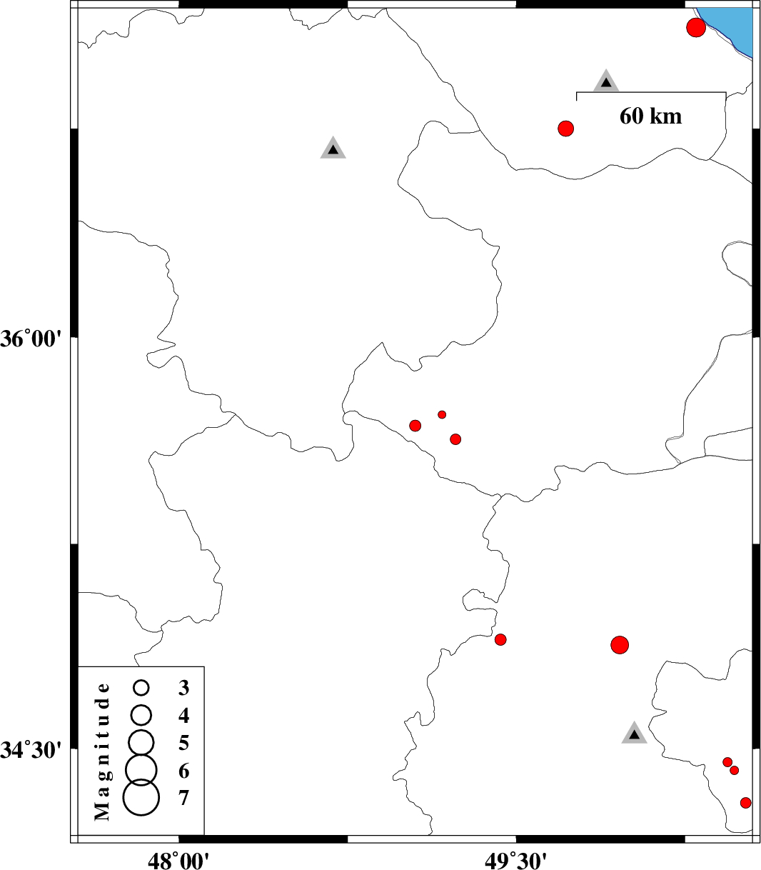
2014/12/19
|
05:59:27.3
|
09:29:27.3
| 35.68 | 49.05 | 29 |
ML:2.3
|
Ghazvin Province, 32 km North of Razan | |
|
|
2014/12/16
|
15:49:11.3
|
19:19:11.3
| 36.75 | 49.72 | 15 |
ML:3.1
|
Gilan Province, 27 km East of Rudbar | |
|
|
2014/12/15
|
12:57:11.3
|
16:27:11.3
| 34.42 | 50.47 | 28 |
ML:1.7
|
Qom Province, 56 km North of Mahallat | |
|
|
2014/11/28
|
14:00:01.8
|
17:30:01.8
| 34.3 | 50.52 | 31 |
ML:2.1
|
Qom Province, 43 km North of Mahallat | |
|
|
2014/11/28
|
08:13:57.9
|
11:43:57.9
| 34.88 | 49.96 | 14 |
ML:3.5
|
Markazi Province, 21 km North of Tafresh | |
|
|
2014/11/23
|
18:49:40.8
|
22:19:40.8
| 34.9 | 49.43 | 18 |
ML:2.2
|
Markazi Province, 59 km North-West of Tafresh | |
|
|
2014/11/23
|
05:07:39.2
|
08:37:39.2
| 37.11 | 50.3 | 15 |
ML:3.8
|
Gilan Province, 3 km Rudsar | |
|
|
2014/11/21
|
11:58:02.0
|
15:28:02.0
| 34.45 | 50.44 | 40 |
ML:1.9
|
Qom Province, 41 km East of Ashtiyan | |
|
|
2014/11/21
|
01:14:16.4
|
04:44:16.4
| 35.72 | 49.17 | 16 |
ML:1.5
|
Ghazvin Province, 39 km North-East of Razan | |
|
|
2014/11/19
|
08:06:48.8
|
11:36:48.8
| 35.63 | 49.23 | 14 |
ML:2.1
|
Ghazvin Province, 32 km North-East of Razan | |