
Magnitude |
:2.3 |
| Date & Time (UTC) | 2014-12-19 05:59:27.3 |
| Date & Time (Local) | 1393/9/28 09:29:27.3 |
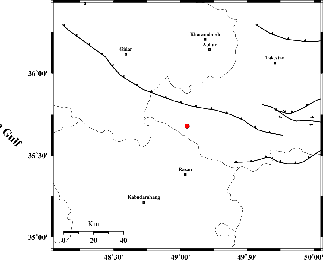
| Location | Lat:35.68 Lon: 49.05 |
| Region | Ghazvin Province, 32 km North of Razan |
Nearest Cities |
|
| 20 km North West of Avaj, Ghazvin Province | |
| 23 km West of Ab-e garm, Ghazvin Province | |
| 29 km North East of Khorandeh, Hamedan Province | |
| 33 km North of Razan, Hamedan Province | |
| 33 km North East of Kahla, Zanjan Province | |
| Depth | 29 km |
| Agency | |
Faults within 150 km: |
|
| KUSHK_E_NOSRAT_F (Length: 230 km) , Distance to epicenter: 11 km | |
| SOLTANIYEH_F (Length: 119 km) , Distance to epicenter: 36 km | |
| IPAK_F (Length: 80 km) , Distance to epicenter: 53 km | |
| Number of Phases | 7 |
| RMS | 0.1 |
| Number of Stations | 5 |
| Error in Latitude | >0.9 km |
| Error in Longitude | 1.2 km |
| Error in Depth | 3 km |
Download waveform in seisan format
to download seisan software Click here
to access information about IIEES stations Click here
Amplitude | ||||||||
| UID | Agency | Station | Component | Amplitude | Period | Arrival Time | Proccessing Time | Signal Clip |
| 94557 | IIEES | THKV | N | 41.9 | 0.2 | 2014-12-19 06:00:13 | 2014-12-19 02:59:00 | n |
Phase | ||||||||||||
| Agency | Station | Component | Phase Type | Phase Quality | First Motion | Observed Arrival Time | Time Residual | Loc. Flag | Input Weight | Distance | Azimuth | |
| IIEES | ZNJK | Z | Pg | E | 2014-12-19 05:59:46 | 0.02 | y | 115 | 343 | |||
| IIEES | ZNJK | E | Sg | E | 2014-12-19 06:00:00 | -0.03 | y | 115 | 343 | |||
| IIEES | ASAO | Z | Pg | E | 2014-12-19 05:59:52 | 0.12 | y | 153 | 144 | |||
| IIEES | ASAO | E | Sg | E | 2014-12-19 06:00:10 | -0.08 | y | 153 | 144 | |||
| IIEES | SNGE | Z | Pg | E | 2014-12-19 05:59:54 | -0.02 | y | 168 | 248 | |||
| IIEES | CHTH | Z | Pn | E | 2014-12-19 05:59:57 | -0.01 | y | 189 | 82 | |||
| IIEES | CHTH | E | Sg | E | 2014-12-19 06:00:20 | 0 | y | 189 | 82 | |||