| Prel. Rep. | Date | Time(UTC) | Time(Local) | Lat. | Lon. | Depth | Mag. | Region | Waveform |
|
|
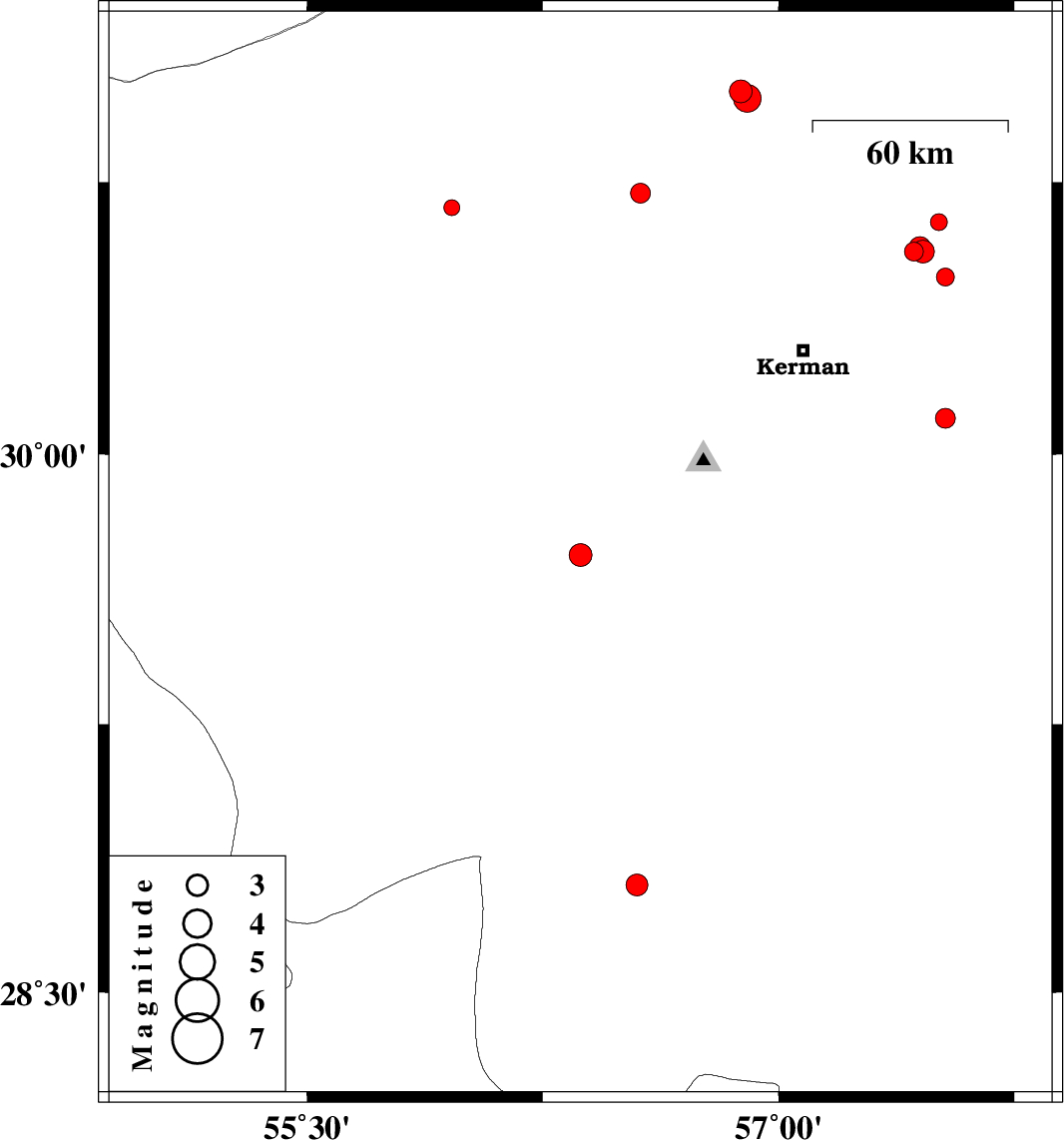
2014/05/10
|
13:36:37.4
|
18:06:37.4
| 29.72 | 56.37 | 14 |
ML:3.2
|
Kerman Province, 30 km South-West of Bardsir | |
|
|
2014/05/09
|
20:54:44.8
|
01:24:44.8
| 28.28 | 55.36 | 18 |
ML:2.8
|
Fars Province, 53 km West of Hajiabad | |
|
|
2014/05/08
|
16:51:16.2
|
21:21:16.2
| 28.28 | 55.28 | 18 |
ML:2.8
|
Fars Province, 61 km West of Hajiabad | |
|
|
2014/04/29
|
04:57:59.3
|
09:27:59.3
| 30.1 | 57.53 | 18 |
ML:2.8
|
Kerman Province, 48 km South-East of Kerman | |
|
|
2014/04/27
|
15:35:25.3
|
20:05:25.3
| 30.56 | 57.43 | 14 |
ML:2.7
|
Kerman Province, 45 km North-East of Kerman | |
|
|
2014/04/25
|
00:30:11.3
|
05:00:11.3
| 30.68 | 55.96 | 14 |
ML:2.2
|
Kerman Province, 31 km North of Rafsanjan | |
|
|
2014/04/24
|
05:16:31.7
|
09:46:31.7
| 30.56 | 57.46 | 14 |
ML:3.2
|
Kerman Province, 47 km North-East of Kerman | |
|
|
2014/04/24
|
01:45:07.6
|
06:15:07.6
| 30.49 | 57.53 | 16 |
ML:2.6
|
Kerman Province, 49 km North-East of Kerman | |
|
|
2014/04/24
|
01:29:09.6
|
05:59:09.6
| 30.57 | 57.45 | 15 |
ML:3.1
|
Kerman Province, 48 km North-East of Kerman | |
|
|
2014/04/23
|
11:15:41.9
|
15:45:41.9
| 30.57 | 57.45 | 14 |
ML:2.8
|
Kerman Province, 47 km North-East of Kerman | |
|
|
2014/04/12
|
23:57:08.8
|
04:27:08.8
| 30.64 | 57.51 | 14 |
ML:2.4
|
Kerman Province, 56 km North-East of Kerman | |
|
|
2014/04/12
|
17:15:47.5
|
21:45:47.5
| 30.72 | 56.56 | 14 |
ML:2.8
|
Kerman Province, 10 km Zarand | |
|
|
2014/04/12
|
01:51:38.6
|
06:21:38.6
| 31 | 56.88 | 14 |
ML:3.2
|
Kerman Province, 31 km South of Ravar | |
|
|
2014/04/11
|
23:36:13.3
|
04:06:13.3
| 30.98 | 56.9 | 14 |
ML:4
|
Kerman Province, 33 km South of Ravar | |
|
|
2014/04/11
|
23:31:27.6
|
04:01:27.6
| 28.8 | 56.55 | 14 |
ML:3.1
|
Kerman Province, 49 km South of Baft | |
