
Magnitude |
:2.6 |
| Date & Time (UTC) | 2014-04-24 01:45:07.6 |
| Date & Time (Local) | 1393/2/4 06:15:07.6 |
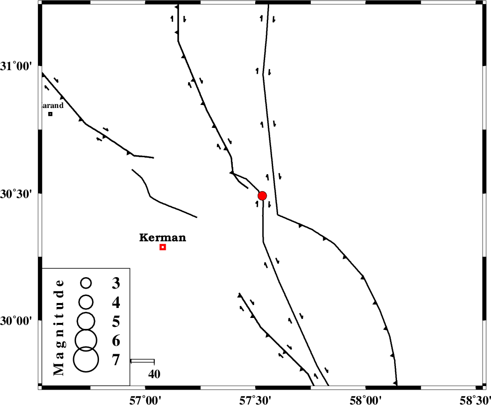
| Location | Lat:30.49 Lon: 57.53 |
| Region | Kerman Province, 49 km North-East of Kerman |
Nearest Cities |
|
| 19 km North West of Shahdad, Kerman Province | |
| 25 km East of Dehlulu, Kerman Province | |
| 31 km North West of Estehkam, Kerman Province | |
| 33 km North of Sirch, Kerman Province | |
| 42 km South East of Harjand, Kerman Province | |
| Depth | 16 km |
| Agency | |
Faults within 150 km: |
|
| GOLBAF_SIRCH_F (Length: 114 km) , Distance to epicenter: 2 km | |
| LAKARKUH_F (Length: 138 km) , Distance to epicenter: 7 km | |
| NAYBAND_F (Length: 258 km) , Distance to epicenter: 11 km | |
| Number of Phases | 6 |
| RMS | 0.1 |
| Number of Stations | 4 |
| Error in Latitude | >1.6 km |
| Error in Longitude | 1.9 km |
| Error in Depth | 2.9 km |
Download waveform in seisan format
to download seisan software Click here
to access information about IIEES stations Click here
Amplitude | ||||||||
| UID | Agency | Station | Component | Amplitude | Period | Arrival Time | Proccessing Time | Signal Clip |
| 92263 | IIEES | TABS | N | 17 | 0.4 | 2014-04-24 01:46:51 | 2014-04-24 03:08:00 | n |
Phase | ||||||||||||
| Agency | Station | Component | Phase Type | Phase Quality | First Motion | Observed Arrival Time | Time Residual | Loc. Flag | Input Weight | Distance | Azimuth | |
| IIEES | KRBR | Z | Pg | E | 2014-04-24 01:45:23 | -0.01 | y | 93 | 233 | |||
| IIEES | BSRN | Z | Pn | E | 2014-04-24 01:45:42 | 0.07 | y | 223 | 42 | |||
| IIEES | BSRN | N | Sg | E | 2014-04-24 01:46:10 | -0.01 | y | 223 | 42 | |||
| IIEES | YZKH | Z | Pn | E | 2014-04-24 01:45:58 | 0.09 | y | 350 | 308 | |||
| IIEES | TABS | Z | Pn | E | 2014-04-24 01:45:58 | -0.17 | y | 353 | 354 | |||
| IIEES | TABS | N | Sg | E | 2014-04-24 01:46:46 | 0.03 | y | 353 | 354 | |||