
| Prel. Rep. | Date | Time(UTC) | Time(Local) | Lat. | Lon. | Depth | Mag. | Region | Waveform |
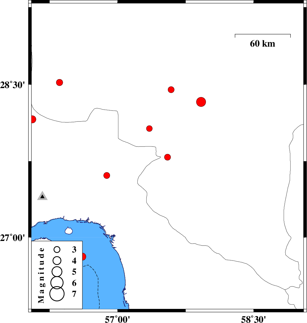
| 2013/04/05 | 20:10:27.2 | 00:40:27.2 | 27.79 | 57.55 | 15 | ML:3.1 | Kerman Province, 23 km South-West of Kahnuj | ||
| 2013/04/03 | 22:59:03.8 | 03:29:03.8 | 28.16 | 56.06 | 14 | ML:3.6 | Hormozgan Province, 23 km South-East of Hajiabad | ||
| 2013/03/28 | 03:27:12.1 | 07:57:12.1 | 28.45 | 57.59 | 14 | ML:3.1 | Kerman Province, 29 km South-West of Jiroft | ||
| 2013/03/25 | 15:57:58.3 | 20:27:58.3 | 27.61 | 56.88 | 14 | ML:3.1 | Hormozgan Province, 41 km North-West of Dehbarez | ||
| 2013/03/21 | 06:16:01.6 | 09:46:01.6 | 28.07 | 57.35 | 14 | ML:2.9 | Kerman Province, 36 km North-West of Kahnuj | ||
| 2013/03/19 | 21:29:30.0 | 00:59:30.0 | 26.81 | 56.61 | 6 | ML:3.6 | Persian Gulf, 37 km South-East of Qeshm | ||
| 2013/03/08 | 21:38:49.0 | 01:08:49.0 | 28.33 | 57.92 | 34 | ML:4.6 | Kerman Province, 42 km South-East of Jiroft | ||
| 2013/03/06 | 13:16:23.2 | 16:46:23.2 | 28.52 | 56.36 | 14 | ML:3.2 | Kerman Province, 50 km North-East of Hajiabad |