
Magnitude |
:3.6 |
| Date & Time (UTC) | 2013-04-03 22:59:03.8 |
| Date & Time (Local) | 1392/1/15 03:29:03.8 |
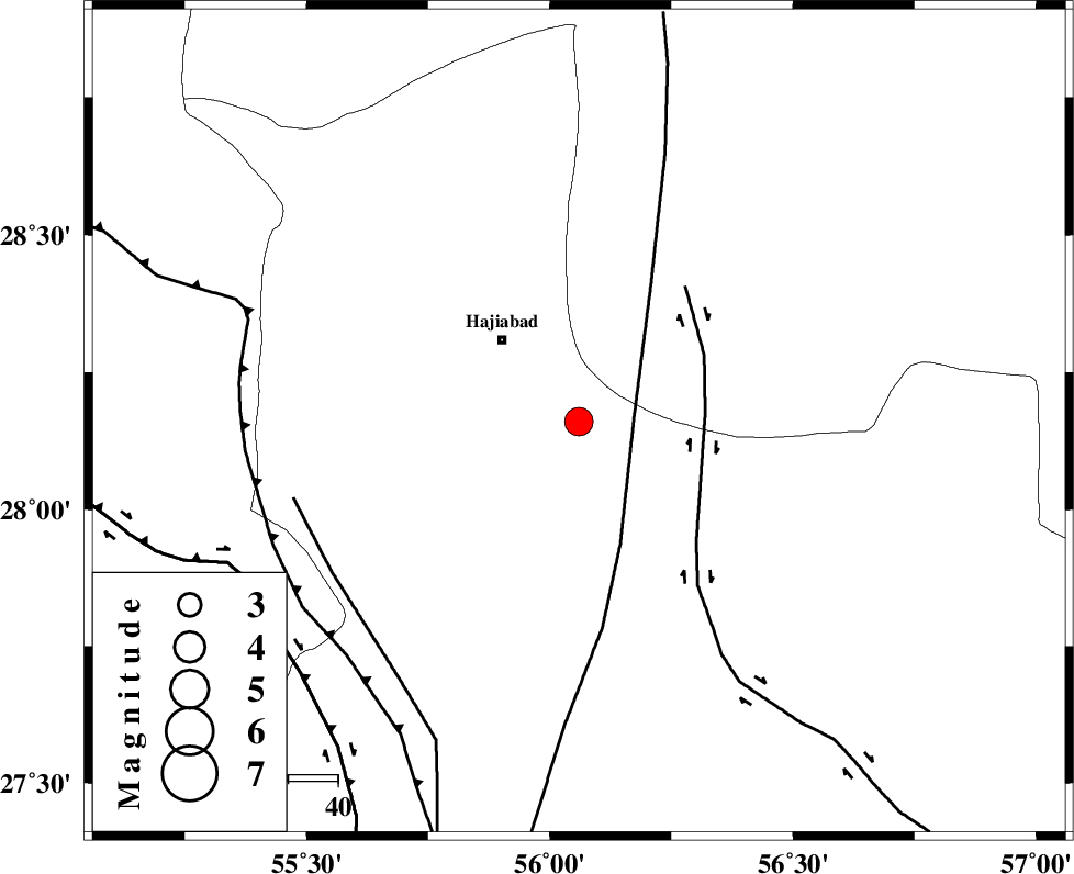
| Location | Lat:28.16 Lon: 56.06 |
| Region | Hormozgan Province, 23 km South-East of Hajiabad |
Nearest Cities |
|
| 23 km South East of Hajiabad, Hormozgan Province | |
| 23 km North West of Fareqan, Hormozgan Province | |
| 43 km South West of Arzuieeh, Kerman Province | |
| 46 km South West of Shahmaran, Kerman Province | |
| 60 km North East of Fin, Hormozgan Province | |
| Depth | 14 km |
| Agency | |
Faults within 150 km: |
|
| HZF2 (Length: 437 km) , Distance to epicenter: 17 km | |
| MAIN_ZAGROS_R_F (Length: 1106 km) , Distance to epicenter: 19 km | |
| HZF1 (Length: 102 km) , Distance to epicenter: 97 km | |
| Number of Phases | 6 |
| RMS | 0.1 |
| Number of Stations | 4 |
| Error in Latitude | >6.4 km |
| Error in Longitude | 4.9 km |
| Error in Depth | 7.4 km |
Download waveform in seisan format
to download seisan software Click here
to access information about IIEES stations Click here
Amplitude | ||||||||
| UID | Agency | Station | Component | Amplitude | Period | Arrival Time | Proccessing Time | Signal Clip |
| 88393 | IIEES | KRBR | E | 480.2 | 0.76 | 2013-04-03 23:00:09 | 2013-04-04 02:23:00 | n |
Phase | ||||||||||||
| Agency | Station | Component | Phase Type | Phase Quality | First Motion | Observed Arrival Time | Time Residual | Loc. Flag | Input Weight | Distance | Azimuth | |
| IIEES | KRBR | Z | Pn | E | 2013-04-03 22:59:38 | 0 | y | 213 | 18 | |||
| IIEES | KRBR | N | Sg | E | 2013-04-03 23:00:04 | -0.02 | y | 213 | 18 | |||
| IIEES | GHIR | Z | Pn | E | 2013-04-03 22:59:49 | 0.03 | y | 302 | 273 | |||
| IIEES | GHIR | E | Sg | E | 2013-04-03 23:00:28 | -0.05 | y | 302 | 273 | |||
| IIEES | YZKH | Z | Pn | E | 2013-04-03 23:00:12 | 0.13 | y | 490 | 344 | |||
| IIEES | BSRN | Z | Pn | E | 2013-04-03 23:00:15 | -0.09 | y | 515 | 34 | |||