
| Prel. Rep. | Date | Time(UTC) | Time(Local) | Lat. | Lon. | Depth | Mag. | Region | Waveform |
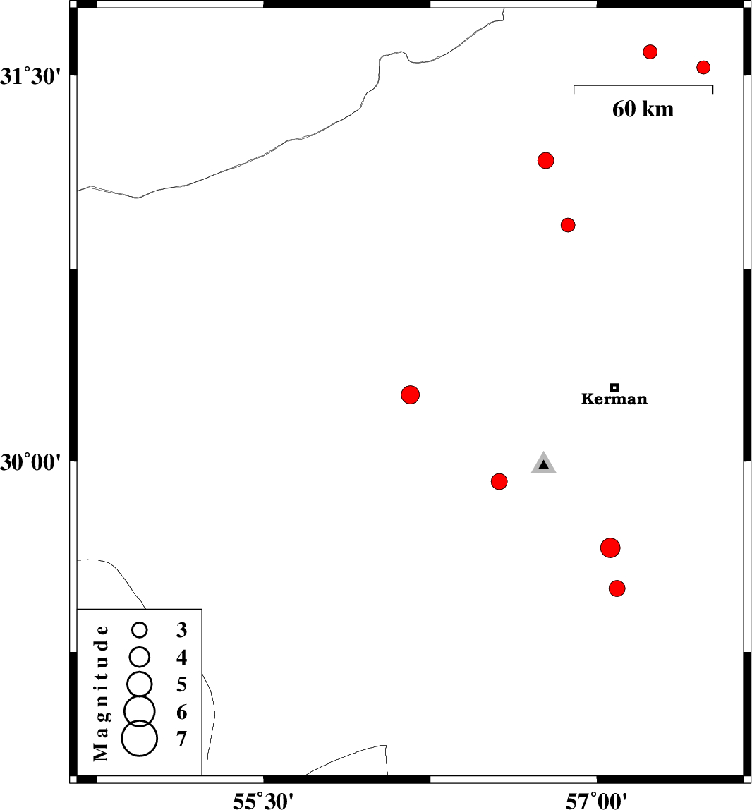
| 2013/02/26 | 03:27:28.9 | 06:57:28.9 | 30.26 | 56.16 | 14 | ML:3.7 | Kerman Province, 22 km South-East of Rafsanjan | ||
| 2013/02/23 | 21:18:06.3 | 00:48:06.3 | 31.53 | 57.48 | 14 | ML:2.7 | Kerman Province, 70 km North-East of Ravar | ||
| 2013/02/23 | 21:16:08.9 | 00:46:08.9 | 31.59 | 57.24 | 16 | ML:2.8 | Kerman Province, 54 km North-East of Ravar | ||
| 2013/02/22 | 01:54:32.6 | 05:24:32.6 | 29.5 | 57.09 | 14 | ML:3.3 | Kerman Province, 56 km North-East of Baft | ||
| 2013/02/22 | 01:39:24.4 | 05:09:24.4 | 29.66 | 57.06 | 16 | ML:4 | Kerman Province, 70 km South of Kerman | ||
| 2013/02/20 | 08:41:32.5 | 12:11:32.5 | 29.92 | 56.56 | 14 | ML:3.3 | Kerman Province, 1 km Bardsir | ||
| 2013/02/19 | 20:12:50.7 | 23:42:50.7 | 31.17 | 56.77 | 14 | ML:3.2 | Kerman Province, 12 km Ravar | ||
| 2013/02/19 | 00:03:50.5 | 03:33:50.5 | 30.92 | 56.87 | 14 | ML:2.8 | Kerman Province, 39 km South of Ravar |